Irish government in row over passivhaus eco building regulations

Local authority pushes for standard with high levels of insulation and ventilation, but Irish government says measure would slow construction of new homes

The Guardian, 17 June, 2015

The Irish government is fighting plans by a local authority in Dublin to make the super energy-efficient passivhaus standard mandatory for new buildings.

In a submission to Dún Laoghaire-Rathdown county council, the Department of Environment said introducing the standard would slow the construction of new homes.

Ireland’s building industry is experiencing a tentative recovery for the first time since the country’s property bubble began to collapse in 2007. The government is eager to accelerate house building in the capital, which has experienced a serious housing shortage.

The passivhaus standard, developed by European physicists in the 1990s, requires high levels of insulation, draught-proofing and ventilation. It is designed to eliminate the need for traditional central heating systems and to drastically cut carbon emissions.

Read More

The wild streets of Galway

The wild streets of Galway

Take an urban safari on the city's waterways

Irish Times, February 22, 2015

I know few betters ways to see wildlife in Ireland than to walk Galway’s inner bay, and waterways. Start from the aquarium in Salthill and follow the prom towards the city. For me, Galway Bay seems most vital on calm autumn evenings, when the syrup-still water shakes with life as mackerel chase sprat inshore, while seals and gulls stalk the frenzy.

The prom brings you to Grattan Beach, where I’ve found everything from cuttlefish to sea stars to small conger eels in tidepools. Past here, you can walk the causeway out to Mutton Island, under an amphitheatre of mercurial light and weather. But don’t venture out here in high winds or very high tides. The causeway was the first place I saw an otter: when I approached at dusk, a lone walker, it slinked from the road into the sea and was gone.

Read More

Walking with the tides

Time your visit to this mysterious tidal island with care

Irish Times, 10 January 2015

For years, Omey Island seemed a near-mythical place to me. Despite exploring much of the Connemara coast I had never been to this tidal island, which you can walk to at low water but which becomes cut off at high tide. Inishbofin, Inishark and Inishturk print their silhouettes indelibly on the western skyline, but Omey hides away under the Aughrus Peninsula.

You can cross the wide strand from Claddaghduff Quay to Omey around low water from roughly half-tide to half-tide. But tidal conditions vary each day, and with the weather, so ask in Sweeney’s shop and pub in Claddaghduff for local advice before setting out.

We crossed Omey Strand an hour before low tide one gusty October day, roughly following a route described in Paul Phelan’s book Connemara and Mayo: A Walking Guide (Collins Press, 2012). Rather than follow the signposts all the way over the strand, this route veers right towards a prominent house near the island’s northeastern corner.

As we crossed the beach, a hearse started out across the hard sands, followed by cars. The burial procession advanced slowly through the grey wind, bound for Omey’s graveyard.

As you reach Omey, turn right and follow the shore, passing the graveyard if you haven’t already. Ignore the sandy road leading inland towards the house and continue along the beach. You can now pick up a sandy track above the curving shoreline and follow the northern coast (no fence-hopping required).

You will come to one beach, then another. Where a fence turns inland above the second beach, follow it to the remains of Teampall Féichín. This medieval church was built on the site of an earlier monastic settlement founded by St Féichín. Omey’s Gaelic name is Iomaidh Féichín, the bed of Féichín.

Return to the beach and continue to follow the shore. This exposed corner of the island is called Guairín, meaning small dunes, according to Tim Robinson’s book Connemara: The Last Pool of Darkness, from which I have gleaned much of my information. It is mostly machair, a sandy grassland only found in western Ireland and Scotland. The grass is populated by snails that use the lime-rich sands to build their shells.

You will reach the island’s northwest corner, where there is another small tidal island offshore, and, further west, Cruagh Island. Follow the shore of Omey as it turns and heads southeast.

The wind was heavy and the sky grey – not a solid grey, but a fluid mass of moving shades and shapes. To the south, towards Slyne Head, the dim sunlight broke through in crepuscular rays. Keep the sea on your right until you come to a small bay. St Féichín’s well, where pilgrims have left strange trinkets, is above the shore here.

In 1841, Omey was home to 396 people; just 10 years later, after the Famine, this had almost halved. The island’s school closed in 1973, and today there is just one year-round resident.

Cross the beach, join the road by two mobile homes and go left, past the lake and back down to Omey Strand. Presuming you haven’t horribly miscalculated the tides, you can follow the posts back across the sand to Claddaghduff.

WALK: OMEY ISLAND, CO GALWAY

Map: OSI, Discovery Series Sheet 37.

Start/finish: Claddaghduff Quay, Co Galway. The turn for Claddaghduff and Omey is about 3.5km north of Clifden on the N59. Turn at Claddaghduff church for the quay, or continue straight for Sweeney’s shop/pub.

Time and distance: Roughly 8km, 2.5 to 3 hours.

Suitability: Easy to moderate walking. Head out well before low tide. Omey has no services.

Secrets of Slieve Bloom

Walk in a wooded valley in the Slieve Bloom mountains

Irish Times, 30 August, 2014

An experienced hillwalker once told me that his least favourite range was the Slieve Bloom mountains of Laois and Offaly. I can’t recall his reasoning, but I imagine it might have been that it’s boggy and fairly flat, with no soaring peaks, and covered in forestry.

But the Slieve Blooms hide glorious secrets. Having lots of wooded rivers in one small range is invigorating, and you can explore one of these by walking the Brittas loop at Clonaslee, Co Laois.

The Slieve Blooms were behind a wall of mist when I approached, after heavy showers soaked the midlands. From the trailhead, the blue markers followed a track into woods along the river, where there was plenty of hazel, beech, ash, and Douglas fir.

These woods are part of the old Brittas estate, held by MP Francis Plunkett Dunne, who built nearby Brittas House in 1869. The Dunnes were said to be descendants of the legendary high king of Ireland, Cathair Mór.

The trail passes an old weir and the ruins of an old bridge. You will pass new footbridges too, but stay on the right bank as the trail goes through a series of stiles. After a while the track climbs away from the river, leaves the wood and joins a grassy lane between two fields.

Hints of autumn were everywhere: blackberries ripening, bracken beginning to rust and birch leaves yellowing. The boreen emerges to a road, where the trail turns right, then immediately left into more woods of beech and holly.

The path brings you to Brittas lake, built as a reservoir for the old estate, with water pumped up from the Clodiagh river. There are picnic benches and old fishing stands.

Beside the lake is a grove of Scots pine, a graceful tree rooted deeply in Ireland’s ecological past. This species once thrived on Ireland’s uplands and marginal habitats, but was pushed out as the climate grew wetter, bogs expanded and early farmers cleared the land. It may have survived in isolated refuges. But most Scots pine across the country today is from Scottish stock.

The waymarkers at Brittas lake are a little confusing, but essentially they direct you to lap the lake fully. As you leave the lake behind, rather than turn left down the path you came from through the woods, continue straight to some barriers, and go left.

There was once a large oak forest here, and you can see old oaks along the track. When you reach a fork, follow the waymarker right. A bit further on, you swing left where a grassy track leads off to the right.

Here a fallow deer and her fawn stood on the path ahead of me. I expected them to bolt, but the mother strayed into the woods, leaving the youngster behind to stare dumbly at me. I moved closer, until the mother returned and both deer darted. The route then crosses straight over a forest road and onto a grassy lane. Where a fallen tree blocks the path, circle around it to the left. The path emerges through an old gate of the Brittas estate to the west side of Clonaslee village.

From here you can continue straight on past some houses to reach the crossroads, where you turn right for the trailhead to complete the loop.

Map: OSI Discovery Series Sheet 54, or download from coillteoutdoors.ie. Start/finish: Clonaslee, Co Laois, 14.5km west of Mountmellick on the R422. From the crossroads by MD Hickey’s pub, take the road south along Clodiagh river, towards the mountains. Trailhead is on your left. Time and distance: 8km, 2 to 2.5 hours, not including breaks. Suitability: Graded moderate. Trail follows woodland trails, forest tracks and farmland lanes. Some parts are wet and muddy.

Those not-so-wild Europeans

Re-creating wilderness on a continent that has almost none

Sierra magazine, July/August 2014

In Ireland’s blustery Nephin Beg Mountains, the state-owned forestry company Coillte is rewilding roughly 11,000 acres of pine and spruce plantation. By thinning the canopy, closing logging roads, and establishing a system of shelters, it hopes to turn this industrial forest and parts of neighbouring Ballycroy National Park into a 27,000-acre recreational wilderness.

Coillte won’t fully liberate the forest to natural processes for another 14 years. But when it does, this will will be a rare parcel of European land unmanaged by humans. “We actually want our landscape to become one where there are no humans driving the changes,” says Bill Murphy, who’s overseeing the project for Coillte.

Nobody is certain how much wilderness Europe has left, but the best estimates say it’s 1 percent or less. Most of this land is in the east, where bison roam Poland’s Białowieza Forest, old-growth trees carpet the Carpathian Mountains, and taiga blankets the Russia-Finland border. The rest of Europe has been paved, cultivated, grazed, logged, urbanized, or otherwise degraded.

Definitions of “wildland” and the laws protecting it vary across the continent. Europe has no shared wilderness literature or history, says Mark Fisher, an honorary research fellow at the Wildland Research Institute; there is no European Muir or Leopold. While America’s early preservationists were idealists who fought to protect wild places from development and safeguard the public’s right to explore them, their European counterparts were instead driven by the science of conserving species and habitats.

The planned wilderness in the Nephin Beg Mountains, called Wild Nephin, is part of Western Europe’s nascent rewilding movement. In Germany, the Brandenburg Wilderness Foundation is returning vast military camps to the wild, while in Scotland, the nonprofit Trees for Life is restoring Caledonian Forest to highlands. All three projects are guided by the principle that nature can take over again, so long as it gets a leg up.

Up to now, hikers have shared Nephin’s forest tracks with logging trucks. But Coillte plans to cease commercial logging, shut out motorized vehicles, and turn forest roads into rough trails. When rewilding is complete, backpackers will be able to hike through Ireland’s most extensive wild forest, camp in backcountry shelters, and explore a roadless expanse of woods, mountain, and bog with no trace of human habitation or modern infrastructure.

It’s a paradoxic, of course, that such rewilding requires human intervention. But if Europe succeeds, hearts and minds may follow, and Nephin’s resurrected forests, bogland, and rivers could serve as a glimpse of Europe’s modern frontier.

Land of woods and water

Walk the woodlands and turloughs of little-known Garryland

Irish Times, 28 June, 2014

You’ve probably heard of Coole Park, the former home of Lady Gregory and setting of famous WB Yeats poems. But you might not have heard of Garryland, which is where Yeats’s hipster cousin might have hung out: it’s just around the corner but way less visited and that much harder to find.

The whole interconnected Coole-Garryland complex must be one of Ireland’s richest nature reserves, with 400 hectares of woodland, turlough, limestone pavement and grassland. But the Garryland side sees little footfall compared to Coole.

Leaving the Garryland car park, the woods along the trail are rich with hazel and ash. These trees are often found together on limestone, and they thrive here on the lowlands east of the Burren.

I recently heard a local farmer say that there’s no place on earth like the Burren in spring and, though you’re not really in the heart of the Burren here, you can sense its presence in the trees, wildflowers and rock.

The old building beside the trail, just after you enter the wood, is used as a summer roost by more than 60 lesser horseshoe bats. Close by there’s also a specially built hibernaculum, an underground chamber for the bats to hibernate in during winter.

We took a side-trail and followed it to a dead end, then continued on a rougher track into the woods. We startled two hares from the path and they hopped off, bouncing noisily through the undergrowth. All along, the trails were spotted with the scat of pine marten.

The air was so warm and sticky that Garryland felt more like primordial jungle than an Irish woodland: bugs attacked my neck, the air was thick and humid, and the wind dropped to nothing.

Later we took a side path down to the dry grassy bed of a turlough. These “disappearing lakes”, fed by groundwater during wet weather, are interwoven with the forests here, stretching their watery fingers deep into the woods. There’s nowhere else in Ireland where turloughs are so intimately associated with old woodland.

We passed a grove of oaks and one old yew, then rested on a rock in a clearing. “It looks like something out of Jurassic Park,” my walking buddy said, staring at the scene in front of us: a small turlough, surrounded by a grassy savannah that was dotted with boulders. I could see what she meant: it looked so green and primeval that we half expected Brontosaurus to emerge from behind the hawthorns.

But when the turloughs rise in wet weather, the trails flood. You probably won’t get far if you come here in mid winter, so visit in summer during a dry spell.

The full linear walk from the Garryland car park to Coole is almost 5km one-way, and you could make this much longer by exploring different side paths. This is what makes Coole-Garryland so special: there are few other places in Ireland where you can spend so long walking through woodland (unless you like walking in circles).

But the swampiness of the day seemed to call for a lazier approach. After resting we turned back, then took a different trail to another turlough fringed by steep limestone crags. Tired and thirsty, we walked back to the car park in the still May heat.

Go Walk: Garryland Woods

Map: OSI Discovery Series Sheet 52 covers the area but may not show trail details.

Start and finish: Garryland Woods car park. From Gort take the R460 towards Corofin, but turn right for Kinvara almost 1km after crossing over the motorway. Follow this minor road for 2.5km and take the first right. The car park is 1.5km up on your right hand side. Room for only a few cars.

Time and distance: My walk was 7km / 2 hours with breaks, but this can easily be made longer or shorter such is the variety of trails.

Suitability: The main paths are flat and easy, but side trails can be rougher. Go during dry weather in summer as the trails flood in wet weather / winter.

Info: Coole Park Visitor Centre (www.coolepark.ie).

Services: There are seasonal tea rooms at Coole Park and full services in Gort.

Fishy chat-up lines and underwater love among Arctic char

Scientists in Galway are attempting to eavesdrop on the sounds Arctic char make during courtship in the hope of protecting this threatened fish

Irish Times, 1 May 2014

What does the fish say? New research at Galway-Mayo Institute of Technology (GMIT) aims to shed light on just how vocal a unique Irish fish is. Biologists hope to discover whether Arctic char, a deepwater inhabitant of Irish lakes, vocalise. during courtship and spawning.

Researchers hope that, by recording char in the lab, they can use its unique call to pinpoint where it spawns in lakes in the hope of offering it better protection.

About 700 species of bony fish are known to vocalise. Most do this by contracting their swim bladder to produce pulsating drum-like calls. In many species, sound is produced by males as they compete with each other and try to attract mates.

Sound travels farther underwater than light, says PhD researcher Marta Bolgan, and it doesn’t dissipate as quickly as chemical signals, making it a logical communication medium for fish. But fish acoustics are poorly understood compared with those of aquatic mammals such as whales and dolphins, and freshwater fish are the least-studied of all.

At a fish farm in Galway, Bolgan has recorded what seem to be sounds produced by Arctic char. She believes these may be the first Arctic char vocalisations recorded by scientists. Bolgan now hopes to record the species spawning in the lab to confirm whether it vocalises, and to figure out why.

To coax the fish into breeding, she tries to recreate its natural spawning conditions in freshwater tanks: cold water temperatures (6-8 degrees) and a short daylight period recreated using lamps.

Bolgan keeps male and female char separately, but once the females are ripe with eggs, she transfers two males and one female to an observation tank. For the first two days she keeps the sexes separate using a divider.

Each time, the males appear to compete until one has established dominance. “One male keeps swimming around the tank and the other hides,” she says. Often the female will dig a nest in the gravel bedding to prepare for spawning.

When she removes the divider, the courtship ritual begins. “The [dominant] male swims with the mouth really close to the tail of the female, and the mouth of the female is really close to the tail of the male. They swim in a circular pattern, and they can go on like this for a couple of hours.”

But there’s one catch: of the nine pairs she has observed at the time of writing, none have completed spawning, and Bolgan has yet to hear any vocalise. She says that because her char are from farmed populations, they may have lost the ability to breed naturally, or her observation tank may be too small for spawning.

“I have a feeling that they rely more on other communication channels. We can’t exclude sound production yet, but maybe it’s not their main communication channel,” she says. Nonetheless, her research still provides new insight into the behaviour of Arctic char.

Later this year, Bolgan will record underwater at Lake Windermere in Cumbria, where the exact location of char spawning grounds is known. She’s hoping to film the fish here too. This should provide better evidence as to whether wild char vocalise during the breeding season.

But even if Arctic char aren’t vocal, they’re still likely to use sound. Bolgan says all fish hear and use sound to pick up information about their environment – for detecting prey, avoiding predators and locating spawning and feeding grounds. Research has shown that many species of reef fish use acoustic information to locate their spawning grounds. “The soundscape is like a fingerprint. Every area sounds different,” she says.

Scientists don’t know how salmon locate their spawning grounds, but sound could provide one explanation. A research student at GMIT now hopes to record salmon vocalising at the Marine Institute facility in Mayo later this year. Understanding fish acoustics is vital for their conservation, says Bolgan’s supervisor, biologist Dr Joanne O’Brien. The idea is to minimise human noise at critical points in their life cycle. One of O’Brien’s long-term goals is to set up underwater recording stations in Irish lakes to monitor fish populations remotely.

While marine mammals tend to communicate in a wide range of frequencies, fish use the same low frequencies occupied by noise from human activities such as shipping, putting them at greater risk.

“Noise affects fish and mammals in the same way,” says Bolgan. If I’m trying to speak with you and the noise gets louder, I don’t hear you.”

“So if my point in the communication is to aggregate with you to reproduce, maybe I don’t hear you, maybe I don’t manage to catch you, and reproduction fails.”

SPLENDID ISOLATION: A BRIEF HISTORY OF CHAR

Arctic char arrived in Ireland after the last ice age ended, more than 10,000 years ago. The species, a member of the salmon family, lives in the cold climates of the northern hemisphere and survives farther north than any other freshwater fish.

Like salmon, most Arctic char populations feed in the sea and migrate up rivers to spawn. But the Irish population is unique, spending its entire life cycle in freshwater – mostly in deep, cold lakes near the west coast.

One theory suggests that, after the ice sheets retreated, Irish char populations simply stopped migrating to warming seas, where competition and the risk of being eaten was higher. It has remained isolated in Irish lakes for millenniums.

Arctic char has been recorded in more than 70 Irish lakes, but is believed to be extinct in about a third of these now. It is rated as “vulnerable” on Ireland’s red list of threatened species, and its decline has been linked to the introduction of non-native fish. It requires cold, well-oxygenated water, so is also threatened by pollution and climate change.

The species spends most of the year in deep water, but comes up to shallow lake beds to breed in late autumn and winter. The female digs a nest and releases her eggs, which the male fertilises externally. But little is known about the specific spawning behaviour of char in Ireland or the exact location of breeding sites.

Marta Bolgan’s PhD at GMIT is funded by the Irish Research Council, while her research at Lake Windermere will be supported by the Marine Institute

Through the heartlands

Walking the Grand Canal Way across the bogs of Offaly

Irish Times, 26 April 2014

I left Tullamore on a proper Irish spring morning: icy wind on my face, warm sun on my back. My plan was to follow the Grand Canal Way west through the boggy heart of the midlands.

Just outside Tullamore the canal passes Shra Castle, built in 1588 by an English solider who married into a local family. But Ballycowan Castle, a bit further on, is even more striking.

Nearby the towpath crosses two aqueducts, engineering marvels that lift one waterway above another. Further on I spotted a peacock butterfly, my first of the year, its rusted wings spotted black, cream and lilac. The countryside here was flat and farmed. Some fields were wonderfully disordered, with overgrown hedgerows and rough grass. Others were smooth and symmetrical, their hedges hacked bare.

Seeing this, I thought of an eccentric landowner in the midlands who once who told me that when walking his land, I would know where his farm ended because the fields would suddenly become boring. He celebrated disorder, and I imagined him cursing the neatest fields beside the canal.

Later I was resting by a bog oak sculpture at Pollagh when a barge named the Cheerful Lady passed. She had left Tullamore when I did, but had fallen behind me waiting at a lock. “Maybe if you get tired they’ll give you a lift,” the man from Waterways Ireland had said. The barge and I exchanged pole position a few times until she pulled ahead at Pollagh, and that was the last time I saw her.

Past Pollagh the towpath vegetation was stripped bare, and I had to trudge through peaty mud. The Grand Canal Way stretches from west Dublin to the Shannon, and is marked along its whole length. The walking is flat, but in places the towpath is rough and muddy, so wear good walking shoes. Though this section follows quiet roads in parts, I encountered few cars. Make sure you stick with the waymarkers – if you walk on the opposite bank, you could find yourself hitting a dead end.

Then the land grew wilder, and the blooming gorse gave away its secret: I had entered bog country, where the canal passes through Bord na Móna’s great cutaway peatlands. The houses disappeared, and the land between towpath and bog filled with a hodgepodge of scrub, wood and field, more interesting that any single habitat. Nearby are the Turraun Wetlands, created when Bord na Móna flooded its exhausted peat fields. They form one section of Lough Boora Parklands, 2,000 hectares of cutaway bog where nature has retaken hold to create lakes, meadows, scrub and woodland. The parklands have walking trails, hides for birdwatching, bike hire and angling lakes.

Along the canal the towpath crosses one of Bord na Móna’s bog railways. Nearby something big seemed to tumble into the canal from the reeds. I scanned the water for an otter’s head, but none appeared. Later I watched a heron stalk fish from the towpath.

Early in the evening, I left the canal at Gallen and walked 2km by road into Ferbane. I had just enough time for a tipple before catching a bus out of the bog country.

Map: Trail maps at irishtrails.ie. OSI Discovery Series maps 48 & 47. Start: Bridge over the canal at the end of Colmcille Street ( a continuation of High Street & Bridge Street), Tullamore. Start on north side of the canal. Finish: Armstrong/Gallen Bridge, 2km south of Ferbane. Time & distance: 26.2km on the canal, plus 2km into Ferbane, took me 7.5 hours at brisk pace. But leave 10 hours of daylight for safety. Those preferring a shorter walk could tackle a stage: Tullamore to Pollagh (15.6km) or Pollagh to Armstrong/Gallen Bridge (10.6km).

The colourful and the curious

Step into the exotic at Massey's Wood

Irish Times, 22 March 2014

Heading through Dublin’s southern suburbs towards the mountains, I’m always buoyed by how quickly city turns to country. My curiosity piques as housing estates fade into small fields, wooded lanes and ramshackle farmyards.

Massy’s Estate lies just beyond the reach of the city, south of Rathfarnham. From the outside it appears a typical wood, but look closer and you’ll find something much more exotic.

I arrived on a February afternoon to hike the trail that follows the Owendoher River through the forest. In the 1930s, trees from Europe, North America and Asia were planted here. Plaques mark many of these specimens, and we tried to determine each tree’s identity before arriving underneath it.

My guesses were almost always wrong, but in my defence I had never seen a Bhutan pine or West Himalayan spruce before. There are western hemlock, cedars, limes and giant sequoia here too.

The exotic trees and infesting rhododendron make Massy’s feel almost sub-tropical. This was once the site of a grand estate, of which there’s evidence all around: stone bridges, garden walls, an ice-house where lamb was stored.

According to Frank Tracy’s book If Those Trees Could Speak, the estate collapsed due to the extravagant lifestyle of the sixth Baron Massy. In 1924 his grandson Hamon Massy was evicted from Killakee House and deposited by the road on his mattress.

The family later moved into a gate lodge on the estate, and Hamon was often seen walking in the woods thereafter. Killakee House was knocked in 1941. Part of the original military road, built by the British in 1803 for quick access to the Wicklow uplands, runs through the grounds.

The Owendoher is a glorious little river, dropping through a long series of falls, pools, and riffles. In 1931, the gardaí found a secret IRA weapons stash on its banks. The elaborate, booby-trapped bunker held a tent, bedding, tinned food, and a supply of rifles, revolvers and explosives.

The riverside trail looked short on our map but was tougher than we expected, climbing about 200 metres over its course. The wood narrows at its upper reaches, bordered by fields and farmyards. From here we looked out over the city, and tried to pick out urban landmarks through the pale afternoon mist.

Up here, high and unsheltered, the wind whipped into the woods, and we had to navigate around pines that had been torn up and dumped across the trail.

At the top of the wood, we turned back, and downhill we crossed the river and joined the nature trail. The Dublin Mountains Partnership has published an activity book for the trail on its website. But our legs were weary, and once someone ventured the notion of tea, we were making our way back to the car park before the light faded.

Map: OSI Discovery Series Sheet 50. Maps at dublinmountains.ie. Start and finish: Hell Fire Club car park, R115. Exit car park on foot, turn left and the entrance is 100m on. Note car park hours. Time and distance: Our route combined the Riverside Trail (white markers) and Nature Trail (orange): 7.5km/2hrs 30mins. Suitability: Won’t trouble experienced walkers; trails may be muddy and blocked by fallen trees. Deer culling may be taking place, heed safety notices.

A tale of two lakes

Walk the Sligo Way through woods, hills and lakeshore

Irish Times, January 25 2014

Hiding between the wild coastlands of Mayo and Donegal, Sligo’s landscape is less dramatic but more lush and green. Benbulbin draws most of the county’s plaudits, so other hills are forgotten. The 78km Sligo Way traverses the county’s less trodden, boggy uplands. I wanted to spend a day exploring it, so headed for the village of Collooney.  From here the trail follows the Owenmore and Ballysadare rivers into Union Wood, where old oaks and mossy crags sit uncomfortably beside spruce plantations. Further east it crosses the high heathlands of Slieve Daeane.

I had feared a dull slog over this hill but instead found real drama at Lough Lumann, a mountain lake with a backdrop of tall heather-coated crags. Showers passed over and mist erased the summit. This is the best kind of hill weather, an interplay of sun, cloud and rain that changes the light and landscape with each moment.

It’s impossible to write about Sligo without reference to Yeats, whose words have become a filter through which we see the county. He wrote “we should make poems on the familiar landscapes we love, not the strange and rare and glittering scenes we wonder at”.

According to John Cowell’s book Sligo: Land of Yeats’ Desire, a chamber tomb near the summit of Slieve Daeane is known as Cailleach Beare’s house. In a note to his poem The Hosting of the Sidhe, Yeats explains that Cailleach was a fairy who “went all over the world seeking a lake deep enough to drown her faery life . . . until, at last, she found the deepest water in the world in little Lough Ia” on top of this hill. But this lake’s name wasn’t on my OS map.

After coming off Slieve Daeane, the trail enters Slish Wood and follows a stream toward the shore of Lough Gill. Yeats was inspired by Walden, Henry David Thoreau’s classic account of life in the Massachusetts woods, to spend a night sleeping here. “I planned to live some day in a cottage on a little island called Innisfree, and Innisfree was opposite Slish Wood where I meant to sleep,” he wrote. He spent a night under the trees, but barely slept for fear of being discovered by the wood-ranger. “However, I could watch my island in the early dawn and notice the order of the cries of the birds.”

If anybody lived here like Thoreau, it was Beezie Gallagher, who was born on the lake’s Cottage Island and later returned to live there, rowing into Sligo regularly. She hand-fed birds and squirrels inside her cottage, and banned a visitor who threw stones at rats. She was rescued after a blizzard in 1947, then in her 80s, but rowed back to her island home after a week of recuperation. She died there in a fire in 1951.

Leaving the forest, the trail crosses rough bogland and woods before emerging to a slipway that looks out on Inishfree, the end point of my walk through Yeats country.

Map: OSI Discovery Series sheet 25. Maps at irishtrails.ie. Route: Marked by yellow arrows, description at sligowalks. ie. West of Slieve Daeane above the tree line a waymarker has fallen over – the trail continues under the power lines. Forestry operations at Balleygawley Woods may mean this section is closed over the next two or three weeks. Suitability: Moderate for hillwalkers,tough trail crosses remote upland, lots of boggy ground. Distances: Collooney to R284/ Ballygawley Woods: 6km. Ballygawley Woods to Slish Wood: 9km. Slish Wood to Inishfree car park: 5km

Take a lazy winter walk

A ramble around the woods and shoreline west of Galway City

Irish Times, December 28, 2013

If you’re like me, the idea of hillwalking the day after Christmas festivities is a tough proposition: my legs are leaden and I am in danger of dozing off mid-walk. Perhaps this time of year lends itself more to sauntering than hiking.

Living in Galway, one of best spots for lazy walking is around Barna Woods and Lough Rusheen, just west of the city. Here the city’s suburban fringe meets its best fragments of wild land. Over a few square kilometres, there’s woodland, grassland, streams, salt marsh, beaches, rocky shore and glacial cliffs.

Every town has somewhere like this – a rich, wild place that’s overlooked purely because it’s so close to traffic and housing estates.

Barna Woods and Rusheen reward those who pay the closest attention. Near the entrance to the woods, for example, is a holy well, where St Enda is said to have rested for a night before travelling to the Aran Islands in the 5th century.

I went walking here the morning after violent winds had cut up the west coast. Huge trunks lay violently severed on the forest floor: had these been fresh victims of the previous night’s storm?

The wind had calmed, but frequent passing squalls showered the woods with hailstones and sent me scurrying helplessly under leafless branches.

The chaotic weather made for a beguiling mix of colours: blue skies, deep grey clouds, green ivy and holly, and the white of hailstones on golden leaf litter. Heavy rain gave momentum to tiny streams, turning them into little cascades of white water.

I remember picking raspberries in these woods as a teenager, but despite searching for the plant many times since, I’ve yet to find it again.

After exploring the woods, head across the coast road to Lough Rusheen park on the edge of Rusheen Bay, a wide and muddy flatland that fills and empties with the tide. Migrating sea trout and salmon pass through here on their way to the Atlantic from the Barna stream, which rises in the bogs west of Galway city and flows into this little bay.

Rusheen is a great spot to indulge in some bird watching, that wonderful activity that starts when you stop walking altogether, and just sit and stare.

Local bird expert Tom Cuffe says the bay’s finest spectacle occurs at the end of summer, when hundreds of migrating sandwich terns gather before flying south to Africa. At this time of year you’ll find wintering curlew, widgeon, teal, grey plover, dunlin and more.

One of Galway’s best keep secrets is the small woodland reserve that Birdwatch Ireland own on the edge of the bay, which was the last stop on my morning ramble.

As I left the wood towards a backdrop of housing estates and the sound of traffic, I watched two farmers in the adjacent field roll out hay for their cattle, one last rural routine surviving in suburban Galway.

BARNA WOODS/LOUGH RUSHEEN

Start and finish: 7km west of Galway city centre on the R336 coast road towards Spiddal, there are car parks for Lough Rusheen (left) and Barna Woods (right) just after a petrol station. Birdwatch Ireland’s reserve is down a turn towards Rusheen Bay Windsurfing about 1km towards Galway City (not much room to park). Suitability: Easy, but bring waterproof footwear.

More than a rocky place

Exploring the trails in the Burren National Park

Irish Times, November 16, 2013

Words such as barren and bleak are used to describe the Burren so often, you could be fooled into believing them. Sure the region’s limestone plains can feel desolate, but on a bright day the Burren proliferates colour: silver rock, lime valleys, turquoise water. That’s before you add the summer orchids and wildflowers. And if you walk the Burren National Park you’ll see a rich mix of habitats – woodland, meadow, pavement, scrub, lake, fen. Early in November I cycled from Gort with the intention of climbing Mullaghmore, the hill that dominates the park. Then I got lost on the way and found myself pressed for time. The area’s web of boreens is gloriously bewildering. But if you see the Craggy Island parochial house you’re in the right vicinity – the house filmed for Father Ted is just down the road here.

When I arrived, I took the orange trail to Knockaunroe turlough. Virtually unique to Ireland, turloughs are lakes fed by groundwater during rainy periods, but they disappear in dry weather. I found a crevice where water seemed to bubble up from the limestone.

The word Burren comes from the Irish boireann, meaning a rocky place. The exposed limestone soaks up heat in summer and releases it in winter, making the growing season unusually long – one reason cattle are brought to the Burren uplands in winter.

Later I walked the nature trail through meadows, wood and limestone pavement. The hazel and ash woodlands may be stunted and fragmented but they are thick and lush, dripping with moss, ferns and lichen. The sun warmed my back, the trees blocked the wind, while bees and midges buzzed around: it could have been high summer if it wasn’t for the rusting bracken and yellowing hazel. I reached a slab of limestone and spotted fossilised corals in the rock. “Each fragment of the Burren is a mausoleum, each hill a necropolis of unthinkable dimensions, containing more dead organisms than there are humans who have ever lived,” Robert MacFarlane wrote in The Wild Places, his account of exploring the untamed landscapes of the UK and Ireland.

Mullaghmore was sometimes visible above the scrub. This hill doesn’t break 200m, but it offers one of Ireland’s most intoxicating vistas. Experienced walkers can tackle the looped trail that visits the summit. But even if you don’t aim for the top, you can still follow the markers as far as Lough Gealáin.

But I didn’t have time, so I followed the trail to the Knockaunroe turlough one more time under greying skies.

Start/finish: Mullaghmore/Gortlecka Crossroads. From Corofin, Co Clare take the R476 to Kilnaboy and turn right on to the L1112 before the ruined church. After about 4.5km you’ll reach a trailhead/car park before the crossroads. Suitability: The Orange Route (Knockaunroe Turlough) and Green Arrow Route (Nature Trail) are graded Moderate. Blue Route (Mullaghmore Loop) is graded Very Difficult, includes some light scrambling and enters remote uplands. Treat it as a full hill-walk with map, compass and full hiking gear needed. Time & distance: Orange Route -1.3km/30mins. Green Arrow Route - 1.5km/40mins. Blue Route - 7.5km/3hrs. Map: OSI Discovery Series maps 51& 52 cover the national park. Services: Corofin, Gort. No facilities at the park itself. Further info: burrennationalpark.ie/trails. The park visitor centre in Corofin opens in summer and runs free guided walks, talks and a bus service to the park.

The Banks of the Boyne

A long stroll beside one of Ireland's most legendary rivers

Irish Times, Oct 19, 2013

photo: una mcmahon

photo: una mcmahon

Walking a riverbank gives you new perspective on a landscape. While climbing a mountain opens the land up around you, walking a quiet waterway hides you from the world. The river becomes your own private highway through the countryside. Was any Irish river historically more important than the Boyne?

Ancient landmarks line this valley: Newgrange, Knowth, Dowth, Trim Castle, the site of the Battle of the Boyne, the Hill of Tara.

We set out from the car park in Navan and followed the old towpath. Canals were built along the river between 1748 and 1800 to make it navigable for trade. Barges carried grain, coal, flour and other goods between riverside mills and the port at Drogheda.

Pleasure boating later became popular, but the waterway succumbed to competition from roads and rail and grew derelict. An Taisce acquired the navigation in 1969, and its seaward end is now being restored.

Above us the sky was heavy with cloud and the forecast was for rain. But the autumn light was clear and liquid, and the landscape full of colour.

The towpath was lined with tall mixed woodland. Autumn leaves were turning yellow and orange as chlorophyll broke down and other pigments took over. Some ash leaves were lemon yellow, and tall gnarled oaks were laden with acorns. We saw a heron fishing by a weir, and watched a moorhen take cover in canal-side vegetation.

I had only come from Galway, but the change in landscape felt dramatic. The trees were taller and stouter here, the fields wider and greener, their boundaries composed of shrubs rather than stone. The land seemed more colourful, though less wild.

My walking buddy picked up horse-chestnut seeds from the towpath, and we went over the rules of conkers to affirm we still knew how to play. “We used to paint them with nail varnish,” she said – to make them stronger in battle, naturally.

We stopped by the ruins of a lock, bridge and cottage. We passed the impressive red-brick manor of Ardmulchan Demesne, the ruins of Dunmoe Castle – which Cromwell’s forces are said to have fired a cannon ball at – and medieval Ardmulchan church and cemetery.

I knew it was unlikely, but I daydreamed that we might see someone rowing a Boyne currach down the river. Unique to this waterway, these ancient oval vessels were made from woven hazel rods and animal hide. Local artist and currach builder Claidhbh Ó Gibne is now helping to revive this craft. He’s building a 36ft version that he plans to sail from Spain to Ireland to mimic the journey of the ancient Celts.

Soon we arrived at six-arched Broadboyne Bridge – an information panel told us it was once customary to bring cattle across the river nearby to ward off fairies and certain diseases.

Then the rain arrived. We sat under a tree and ate lunch, then turned around for the long walk back to Navan in the fresh autumn drizzle.

GO WALK: BOYNE RAMPARTS WALK, NAVAN Start & Finish: Ramparts car park, Navan, just outside the town centre on the R153. If you have two cars you could finish at the car park/trailhead by Broadboyne/Stackallen Bridge rather than return to Navan.Distance: 16km (8km if going one-way).Map: OSI Discovery Series Sheet 42Suitability: Easy, flat path but there are no facilities or escape points along the way.

Ireland’s big rewilding project first of its kind in Western Europe

Wild Nephin project aims to create 27,000 acres of unique wilderness landscape

Earth Island Journal, October 16, 2013

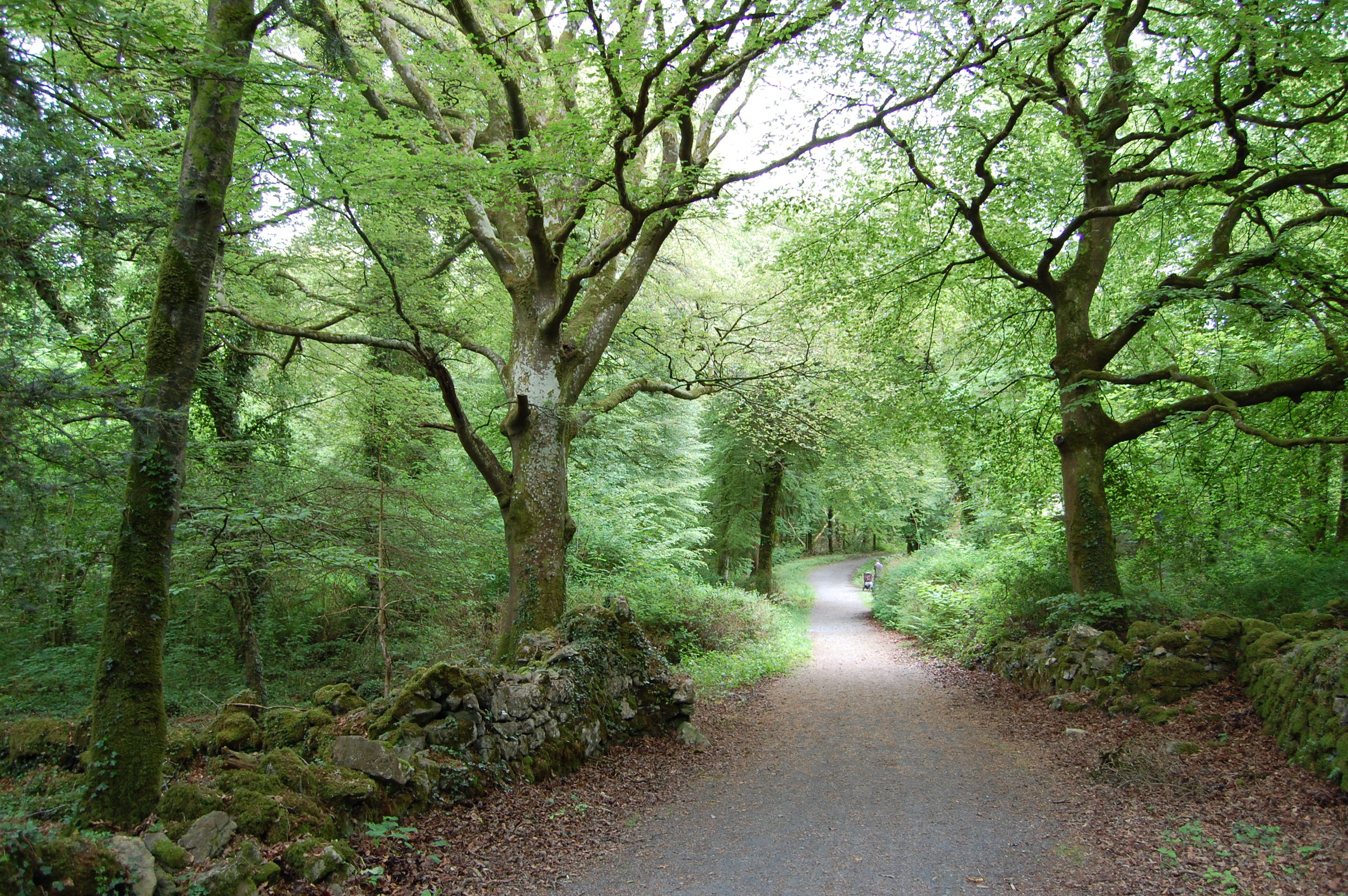
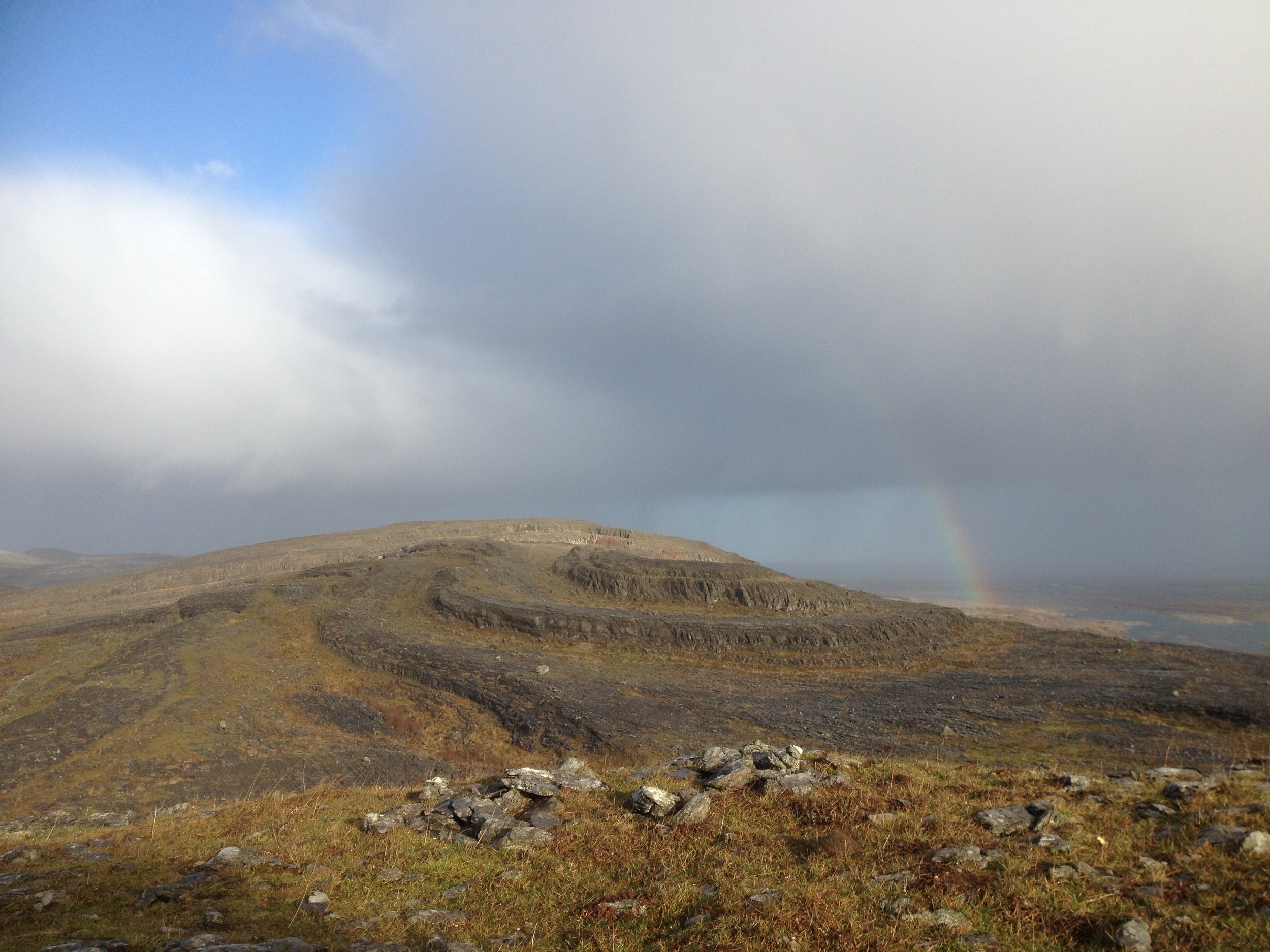
The Nephin Beg mountain range rises on Ireland's western coast and stretches 20 miles into the sparsely populated northwest of County Mayo. This is a landscape of boglands and heath-covered mountains, battered by Atlantic winds and rain. The only forests here are stands of Lodgepole pine and Sitka spruce, planted in an attempt to wrestle economic gain from the unproductive soil.

On a long coastline of wet, weather-beaten hills, the Nephin Begs aren't unique. But they form one of the few big areas of roadless, uninhabited terrain in Ireland.

Now this range is home to a pioneering re-wilding project. In March, Ireland's National Parks and Wildlife Service, and Coillte, a public forestry company — the region's two big landholders — designated 27,000 acres of bog, mountain, and forest out here as Ireland's first wilderness area, Wild Nephin.

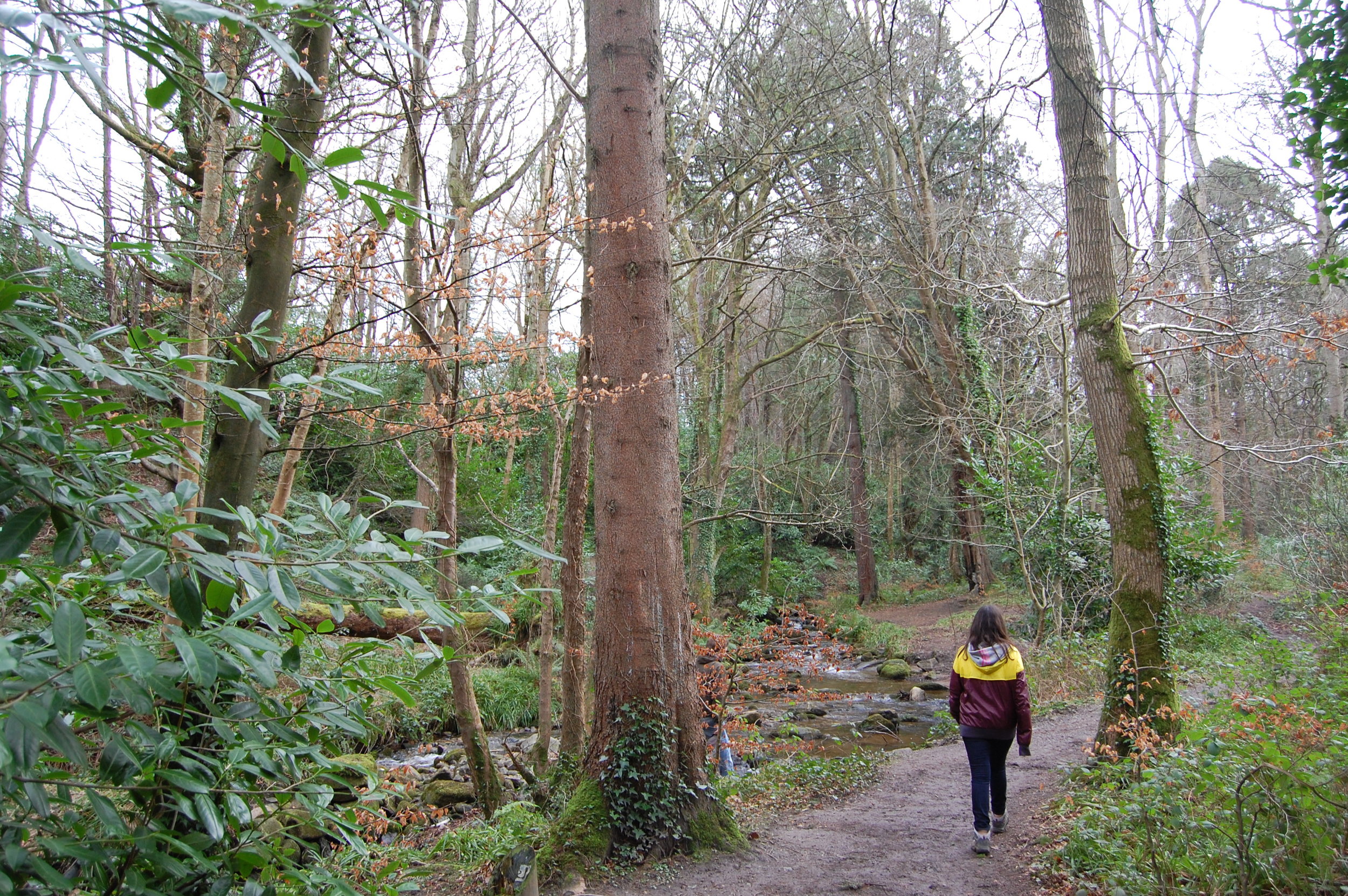
The project has three core aims: to protect a large wild landscape, re-wild the forest, and provide a "primitive" wilderness experience for visitors.

Over the next 15 years the project will aim to "naturalize" the plantations. It will thin the forest cover to let more light into the understory, create more clearings, restore areas of bogland, and plant some native species. Trees will be felled but left in place to mimic natural catastrophes and encourage regeneration. Forest roads will be closed and converted to trails.

While many conservation areas in Ireland are utilized in some way — often for sheep and cattle grazing — Wild Nephin will seek to create a wild, "self-willed" landscape. "What we want to do over the next 15 years is re-engineer the forest, so in 15 years time when we step out of the management of the area, then only wild processes will change the landscape," says Wild Nephin project manager Bill Murphy.

The region is not yet a perfect wilderness. In 2002, Ireland was prosecuted by the European Commission for allowing part of the region to be overgrazed by sheep (stocks have since been reduced). The Nephin forests also bear the scars of past logging. The re-wilding project will not seek to remove the non-native conifers that dominate the forests; instead it will encourage natural regeneration.

The Wild Nephin project is part of a loose but growing movement to create and protect wilderness across Europe, and to re-wild ecologically degraded landscapes. Germany, for instance, is aiming to designate 2 percent of its land area as wilderness by 2020.

The nonprofit Rewilding Europe aims to rewild one million hectares of land by 2020 and create 10 “magnificent” wildlife and wilderness areas. The group hopes its efforts “will serve as inspirational examples of what can also be achieved elsewhere.” Another organization, Pan Parks, also plans to safeguard one million hectares of European wilderness by 2015. Pan Parks oversees a network of wilderness areas, including mountainous regions in Eastern Europe, an island archipelago in Finland, and forests and boglands in Estonia and Lithuania. All these areas are within existing national parks, but must now satisfy the Pan Parks' definition of wilderness, which prohibits logging, hunting, fishing, agriculture, roads or construction in designated areas.

Earlier this month, the World Wilderness Congress was held in Salamanca, Spain — the first time in 20 years Europe hosted the event. Wilderness groups published a document, A Vision for A Wilder Europe, calling for the continent's last wilderness areas to be protected, and for natural processes to be allowed shape more of Europe's land.

"If we can get people behind our cause, then we can say that no more wilderness is going to be lost in Europe," says the Pan Parks' executive director Zoltan Kun.

The term re-wilding is often used to describe the re-introduction of big, locally extinct species — like the gray wolf in the United States’ Yellowstone National Park. But in reality it often means less eye-catching projects like Wild Nephin, which aim to restore landscapes and allow wild processes to take over. And indeed, iconic species of bear, lynx and wolf are all making a comeback across Europe.

"Wilderness probably wasn't even on the European radar in philosophical terms if you go back 20 years," says Toby Aykroyd of the Wild Europe Initiative, an alliance of conservation and wilderness groups. But that has changed. Momentum for rewilding stems from a 2009 motion passed by the European Parliament that called for more wilderness protection, and for wilderness to be defined and mapped. Last year the European Commission published a biodiversity strategy that mentioned wilderness for the first time.

However, most of the wilderness that remains in Europe is in the east of the continent. In densely populated, urbanized Western Europe, little land is truly wild. In Ireland even the most remote mountain valleys provide grazing for sheep, while in the UK national parks protect cultural landscapes as much as wild ones, with villages and farms inside their boundaries.

"Wilderness is not a word you'll find in all European languages, so it's very difficult for there to be a common literature or history [of wilderness preservation]," says Mark Fisher of the Wildland Research Institute at Leeds University, UK.

In this, Europe differs from the United States, where the writing of early wilderness advocates —from John Muir to Aldo Leopold and Edward Abbey —seems to have taken root in the national psyche.

"If you look at the history of protected areas in America... there was a movement to protect areas of huge scenic quality," Fisher says. In Europe, however, early conservation movements were science-driven, he says. They aimed to protect landscapes where important species and biological communities thrived. And because of that, an emotional response to wild places never became embedded in European culture, Fisher says.

The idea of rewilding areas in a continent where the human imprint is so large, has set off a debate over best conservation practices. Earlier this year, the British writer and environmentalist George Monbiot provoked heated discussion with his latest book Feral: Searching for Enchantment on the Frontiers of Rewilding, and a series of articles that took a pointed look at the aims of conservationists. Monbiot criticized UK conservationists for their "intensive management of the natural world".

"Nowhere else does conservation look more like a slightly modified version of the farming which trashed the land in the first place," he wrote in a column on the Royal Society for the Protection of Birds website. Monbiot believes rewilding should involve reintroducing missing animals and plants that were once native to a region, and abandoning “the biblical doctrine of dominion” that assumes it is our duty to “control and corral” nature. "In my view most of our conservation areas aren’t nature reserves at all. They are museums of former farming practices, weeded and tended to prevent the wilds from encroaching," he writes.

Even groups that aren’t pushing as hard for species reintroduction agree that conservation efforts in Europe have been too focused on preserving individual species and habitats rather than whole dynamic ecosystems. "I think traditional conservation has got stuck in a rut around a kind of gardening ethos," says Toby Aykroyd of the Wild Europe Initiative.

But campaigners seem to be chipping away at this thinking. The Wild Europe Initiative includes big conservation groups such as Birdlife International, UNESCO, and the WWF. The European Commission recently commissioned the production of guidelines for "non intervention" management of wild areas, and an official register of wilderness in Europe is in production.

The Wild Nephin project was recently the centerpiece of a major conference, held in Irish town of Westport, on wilderness in modified landscapes. Inherent in this theme was the acceptance that, in Western Europe, wilderness will have to be created by rewilding habitats that have been modified by humans.

"The whole idea of wilderness in Europe is going to be different from the idea of wilderness in North America," says Wild Nephin’s Bill Murphy says. "We have to come up with a context that suits our culture."

Zultan Kun of Pan Parks believes that ultimately, there's a moral obligation —both to the developing world and to future generations — to protect wild land in Europe. "We always talk about protecting the Amazon rainforest, or protecting Borneo. And while we argue for that we destroy our nature here," he says. Kun stresses the difference between rewilding and restoring wilderness — you could rewild your city garden, but you won't get a wilderness.

These are still early days for the wilderness movement in Europe. While Pan Parks might be one of Europe's biggest wildland advocacy groups, Kun told me the group employs just four people who all work from home. He was working from his daughter's bedroom when we spoke.

Kun dreams of turning 5 percent of Europe into protected wilderness. Right now an estimated 1 percent of European land is wilderness, and another 1 percent is near-wilderness that requires restoration.

But environmentalists see the potential to drastically increase this, partly due to high levels of land abandonment across Europe. And Kun believes that as economic recession dries up funding for conservation in Europe, the political environment could favor a more hands-off approach to managing protected areas.

"We have the favorable political environment to take wilderness further, but we need to create massive public support for it," he says.


Restorative ramble

A stroll through one of Co Dublin’s oldest woodlands

Irish Times, Sept 14, 2013

There’s so little old woodland in Ireland it feels like an exotic habitat. Trees once covered our island, but today walking in woods is a novelty compared to walking on hills, beaches or bog. I was browsing a study of ancient Irish woodlands recently, hoping to discover those last places this primeval landscape survives and came across one listing for Dublin: St Catherine’s Wood, Lucan.

One Sunday evening in late July, I caught a train from Connolly station to Leixlip Confey and walked to St Catherine’s. The sun was coming out after a heavy downpour and a rainbow formed over a field where highland cattle grazed. This hardy, mountainous breed was introduced here last year to improve meadow biodiversity. The cattle will graze and trample some parts of the field more than others, encouraging a wider range of plants to grow.

The old wood is just inside the Dublin county border. St Catherine’s gets its name from a priory founded by Warisius de Pech here in 1219. At the time it was considered the duty of Anglo-Norman lords to establish religious foundations to save their souls and those of their ancestors.

Over the centuries the estate passed between different owners. Trinity College pharmacy professor Christopher O’Connor owned the lands in the 1940s and 1950s. He grew exotic plants such as poppies, carnations and deadly nightshade, which were sent to a pharmaceutical plant in Tipperary, according to an article by local historian Mary Mulhall in the Lucan Newsletter in 2012.

The OPW bought the estate in 1996.

My walking buddy and I followed the path into the woods which sit on a steep glacial ridge above the Liffey. The canopy here is dominated by ash and beech. The latter was introduced to Ireland in the 16th century. There’s plenty of sycamore here too, but only the odd oak.

Some rare woodland plants recorded at St Catherine’s suggest this wood may be ancient. The naturalist Robert Lloyd Praeger found the yellowbird’s nest plant here in 1934, although it hasn’t been seen since. More recently the common toothwort was recorded.

We took a side trail down to the remains of an old sluice gate, where the Liffey is squeezed through a narrow gap in a torrent of whitewater. A kayaker was play- boating in the rapids. We startled a heron on the riverbank and watched a woodpigeon drink from the water.

Then we rejoined the main path and climbed to the upper woodland, following the trail back towards the cattle field and out of the woods.

Our stroll left me thinking that even though there are too few of them in Ireland, woodland walks always provide the most restorative kind of ramble.

Robert Louis Stevenson, in one of this travel essays, wrote: “It is not so much for its beauty that the forest makes a claim upon men’s hearts, as for that subtle something, that quality of the air, that emanation from the old trees, that so wonderfully changes and renews a weary spirit.”


At one with wilderness

Hiking Ireland's first wilderness area

Irish Times, August 17, 2013

We simply need that wild country available to us,” the US novelist and historian Wallace Stegner wrote, “even if we never do more than drive to its edge and look in.” This is an arresting idea: that wild places nourish our spirit even if we never enter them.

If there is true wild country anywhere in Ireland, it’s in the Nephin Beg mountains of north-west Mayo. In March, Coillte and the National Parks and Wildlife Service designated 11,000 hectares of bog, mountain and forestry here as Ireland’s first wilderness area, dubbed Wild Nephin.

And you can do more than just look in from the edge. Three looped trails at Letterkeen explore the southern part of this wilderness. In early July I set out on the 12km Letterkeen Loop (marked with purple arrows), crossing a footbridge over the Altaconey river and following the bank of a quick, shallow stream. The ground was thick with tall bracken, the trail hard to make out.

The trail crossed streams, traversed wet bog and climbed to over 200 metres in the first few kilometres. The track here is often sopping wet, but after warm weather it was mostly dry.

An hour and a half later I arrived at the Lough Avoher hut (pictured above), a small lean-to for backpackers, built last year by the voluntary group Mountain Meitheal. I had brought my camping gear; this would be my bed for the night. I cooked some pasta and climbed a little up the hill behind the hut to watch the sun set. Then I went back and settled into my sleeping bag. A swarm of midges biting my face woke me at 6am.

In 1964, the US became the first country to legally designate wilderness — public land without roads or mechanised transport, where “man himself is a visitor who does not remain”.

Conifer plantations are often unloved by hillwalkers, but they still offer remoteness and solitude, and plans to ‘re-wild’ the Nephin forests could provide an exciting blueprint for other plantations. The goals of Wild Nephin are certainly inspiriting. Coillte will set aside 4,400 hectares of forestry and re-wild it to improve habitat and boost biodiversity. Forest roads will be closed and converted to trails, and basic shelters and campsites developed for backpackers. Coillte says the region will offer solitude, challenge and “primitive recreation”.

After breakfast, I followed the trail above the forestry. I studied a damselfly, watched a group of ravens play over Nephin Beg mountain, and startled a frog from the grass. I followed the muddy trail up to a 311 metre summit: take care here and stick with the markers, there is very steep ground nearby. Then I descended through the forest to a track that soon joined the Altaconey river again. The mature forest here was thick with ferns, lichen, and moss. Soon I arrived back at the car park, and stepped out of the wild country.

Map: OSI Discovery Series Sheet 23, but older maps may show old trail route. Up-to-date trail route and map at mayotrails.ie. Time and distance: 12km, 3-4 hours Trailhead: Brogan Carroll bothy, Letterkeen, Co Mayo. From Newport, take N59 towards Achill but turn right after 1km, signposted for Letterkeen Loops. Continue for 12km, past Lough Feeagh. Turn left just after a small bridge for the trailhead. Two shorter loops, the Bothy Loop (6km) and Lough Avoher Loop (10km) also start here. Suitability: Remote and tough trail that climbs above 300m where mist is common. Wild camping experience is advised if you are staying in the Lough Avoher hut. Streams here swell quickly during rain. Practice Leave No Trace (leavenotraceireland.org)

A walk in the woods

Exploring the captivating woodlands on the shores of Galway Bay

Irish Times, 1 June 2013

You can climb mountains in search of wildness and yet find it in the most ordinary of places. Rinville is a typical park of woods and meadow near Oranmore, east of Galway city. When I first came here as a teenager the richness of the forest hooked me. The trampling of human feet made most suburban woodlands I knew barren, but here the understorey was thick with life.

The wild places we explore as kids dig themselves into our memories – their sights and smells never leave us, and it only takes the slightest sensory trigger to send us right back.

This place has changed little through the years. I went back in mid-May, when the forest floor was dense with the bloom of wild garlic. Glance quickly and you think the ground is covered in snow – only the bluebells poking through the whiteness give the game away.

The woods here are small, but big enough to feel pleasantly lost in – you can look in all directions and see nothing but sycamores. There’s plenty of beech, horse chestnut and ash too. On our island of few trees, this is the kind of place that reminds you what a wood is supposed to look like.

The evening was humid, the air thick with the scent of garlic, and when a heavy shower fell it seemed as if the forest was steaming. Swallows fed acrobatically in the meadows, and the call of the cuckoo was a constant presence.

Walking the dogs here once years ago, a fox cub came ambling up the trail towards me, its head down, sniffing intensely. It was just yards away from the dogs when it finally looked up, realised the gravity of its navigational error and dashed into the undergrowth, the dogs chasing after it in vain. There are otters in the pond and streams here too apparently, though I’ve yet to see one.

The park’s trails bring you to Rinville Castle, a 16th century tower house, and to Rinville Hall, a ruined Georgian manor. South across a narrow inlet of Galway Bay is the commanding facade of Ardfry House. Over the centuries these properties were variously owned by wealthy Galway families such as the Blakes, Athys and Lynchs.

It’s one our landscape’s great contradictions that, although our landed estates are symbols of gross inequality, they have given us some of our finest public spaces and nature reserves, partly because their owners could afford not to work all their land to the bone.

Once you’ve walked the park, head down to the sailing club and follow the track that heads out above the rocky shore towards Rinville Point. Here I watched a cormorant diving in the shallows, and an irritated heron fly up and down the strand trying to avoid walkers.

Outside the forest the scent of gorse floated through the air, and the sky was chaotic. To the west clouds edged slowly forward like glaciers, the sun slicing through in horizontal planes. But to the east a tremendous blue-grey wall of cloud obscured everything, and turned the sea the same colour.

Soon this monolithic cloud was over me, then it started emptying its waterload. Near Rinville Point, I turned around and faced into the long, wet walk back to the car park.

How the mountains saved me

How the mountains saved me

A personal essay on spending time in the Irish hills

Earthlines magazine, May 2013

The remote stretch of coastland on the north-west of Achill Island is sometimes called ‘the back of beyond’. The island is tethered to the County Mayo mainland by a swing bridge that resembles a leviathan’s fleshless ribs. When you come to Achill you enter the belly of the whale.

From Achill Sound you could head across boggy hills to the cliff-fringed south of the island. This little-visited district is Gaeltacht, an official Irish-speaking region, but the language is rarely heard here today.

Or you could head north, where horizontal bog gives way to sand dunes and a chain of north-facing beaches. From the Bullsmouth you could ask a local boatman to take you through racing tidal currents to Inis Bigil, an island-off-an- island, population twenty-five.

Or you could go west, where the Atlantic terminates moodily on the two-mile arc of Trawmore beach by the village of Keel, and bungalows clutter the coast like a messy monopoly board. The road ends with a vertiginous drop to Keem, a beach of calm water and flaxen sand encased by steep hills. Between 1947 and 1975, the landing of twelve thousand basking sharks bloodied the waters here.

Heinrich Böll wrote that on Achill he could ‘play truant from Europe’; it is a wild place with wild planning. A fading holiday home development sits on the side of Croaghaun mountain, approved by god knows who. In Keel village, there’s a gaping pit where the construction of a hotel was abandoned. And high on the Pollagh bog in November 2011, a local developer built his bizarre ‘Achill henge’ monument: thirty concrete columns in a perfect circle thirty metres across. The developer described it as a ‘place for reflection’; many see it as a tomb for the Celtic Tiger.

Read More

Island in the sun

Lenny Antonelli takes a spring walk on one of Connemara's less visited islands

Irish Times, April 27, 2013

Inis Ní always seemed elusive to me. I had often passed the seductive signpost for the island after coming over the vast and empty Roundstone bog. Just when you think you've found the wildest coast in Connemara, there is Inis Ní, stretching further into the sea. The island's new looped walking trail seemed a good excuse to finally explore it. On a grey April day the cone of nearby Cashel Hill had emerged from the mist to dominate this bogscape. But slowly the sun came out and dissolved the cloud, turning the sky blue-bright and revealing the Twelve Bens, which dwarfed everything.

You can see why this mountain range is iconic: their clustered, alpine profile pierces the skyline from north Connemara right down to the Burren.

Inis Ní is one of the most northerly outposts of the south Connemara Gaeltacht. But in Listening to the Wind, the first of his Connemara trilogy of books, Tim Robinson says use of the language has declined to the point that it is no longer a bona fide Irish-speaking community. The island's name, he says, might relate to the surname Ó Niadh.

The trail followed a quiet road past granite walls caked in lichen and moss, old peatland inundated by the tides, and patches of earth blackened by the burning of gorse. There were signs of modern Ireland too, like obtrusive bungalows and unfinished buildings, but the deeper into Inis Ní you go the further you feel from 21st century Ireland.

The trail runs down the west side of the island, looking over the water to sandy Gorteen Bay, Errisbeg Hill and the village of Roundstone that Scottish engineer Alexander Nimmo founded in the 1820s.

According to Tim Robinson, the island's tradition says that local landlord Patrick Blake evicted what few tenants remained after the famine and turned Inis Ní into a sheep ranch. This was before the first bridge was built, when the island could only be reached by scrambling across rocks at low tide. But when the ranch failed Blake brought new settlers in from nearby Carna.

I walked down to a pier overlooking Roundstone Bay, and stopped to explore the tidepools. These habitats are our own miniature coral reefs, rich in biodversity. In just one I counted beadlet anemones, polychaete worms, a rock goby, tiny crustaceans, limpets, dog whelks, and all manner of algae and lichens.

In The Story of Connemara, Patricia Kilroy writes that a Mrs Faherty of Inis Ní, who used to walk for miles carrying a basket of fish on her back to meet the train to Galway, had recalled, "the joy of welcoming the travelling fiddler, the dancing in a cottage that night, followed the next night by crossroads dancing — for no house could contain the crowds. In fact, most elderly Connemara people remembered the happiness of their youth rather than the hardship."

The sun was, the coconut scent of gorse filled the air and cattle dozed on the grass — this felt like the first day of spring.  I left the marked trail and took a cul-de-sac towards the island's barren southern tip, where a cacophony of birdsong emanated from the heath.  Then I made my way back to the marked route and followed it past the ruined chapel of St Mathias with its graveyard, past another small harbour, and back towards mainland Connemara.

Inis Ní loop, Co Galway

Map:  OSI Discovery Series Sheet 44 or Tim Robinson's map of Connemara published by Folding Landscapes. Trail map at irishtrails.ie.

Suitability: Easy. Minor roads & tracks.

Start & finish:  The turn for Inis Ní/Inishnee is off the R341 2km north-east of Roundstone. Cross the bridge and the trailhead is on your left.

Distance & time: Inis Ní Loop is 6km (two hours). My extension added an extra 3km (one hour).

Services: Roundstone, Clifden

Dawdling along the Dodder

Irish Times, April 13, 2013

Lenny Antonelli walks the Dodder river through Dublin

By the time they reach cities, most rivers have deposited their personality: they're flat, dull, dirty. But the Dodder is different. Flowing from Kippure mountain to the Liffey, it's a river rich in whitewater and wildlife.

I set out from Ringsend, once separated from the city by the Dodder's sprawling estuary, until the river was brought under control and the marshlands were reclaimed in the 18th century.

But in the years that followed this area was lawless, a refuge for outlaws that was known for its burglaries and highway robberies, according to Weston St John Joyce's 1912 book The Neighbourhood of Dublin.

A little egret was foraging in the shallows of the river at Ringsend. Once rare in Ireland, these small herons are now common in coastal counties.  When breeding they develop extravagant plumage, which was once so popular for decorating hats that it threatened the species.

Walking the Dodder gives you an alternative view of the city, showing you islands of countryside in the suburbs, and fragments of architecture that remind you Dublin was once built around its rivers as much as its roads.

But this was the wrong time to walk the Dodder. It had flooded after heavy rain and deposited all manner of rubbish along its banks. But every year the group Dodder Action undertakes a big clean up of the river, restoring it to wildness.

Snow started falling, but anglers braved frigid temperatures on the riverbank. After Donnybrook and Clonskeagh, the riverside paths wind through parklands, passing weirs, waterfalls and rapids.

A watercolour painting titled 'On the River Dodder near Rathgar' by the 18th and 19th century artist John Henry Campbell shows a dramatic country scene: tall trees looking over a waterfall, a farmstead on the riverbank, the Dublin Mountains looming behind.

Near Rathfarnham a grey heron, surely the most zen of all birds, stood motionless on a branch high above the river. As passerby told me this was also a great place to see foxes, and that there were mandarin ducks on this stretch of the river too. And a minute later, a group of strikingly coloured males — white, brown, blue, pine green and orange — flew past. At Bushy Park another man pointed out the best spots to see kingfishers and dippers.

Then near Firhouse a flock of starlings — called a murmuration — floated in unison across the dusky sky, creating all manner of shapes that dissolved as quickly as they formed.

Starlings form these huge groupings to avoid predators, keep warm and exchange information such as where good feeding spots are, according to the Royal Society for the Protection of Birds.

In his poem 'Down by the Dodder', the Rev Matthew Russell, founder of the Irish Monthly, confessed that he had spent too long living near the river without exploring it.

"And so from life's loud, dusty road / A somewhat jaded plodder," he wrote, "I steal to this serene abode / And thee suburban Dodder!"

The Dodder, Ringsend to Firhouse, Dublin

Start: Ringsend Bridge

Finish: Dodder Valley Linear Park, Firhouse Road. Bus 49 heads to Pearse St from stop 3004 on nearby Ballycullen Ave.

Route: There are paths near the Dodder most of the way, but for some stretches you must detour away from the river. Bring any detailed street map to find your way.

Suitability: Easy, but the river rises quickly and floods during heavy rain so avoid it at these times. Walk on designated paths rather than on the bank itself. Bring walking footwear, rain gear, snacks, water.

Time: A leisurely five hours

Distance: Approximately 15km