Calling the curlew home

RTÉ Lyric FM, 5 March, 2023

A radio story on the Eurasian curlew and its elemental place in Irish culture

Photo: JANICE MULLIGAN

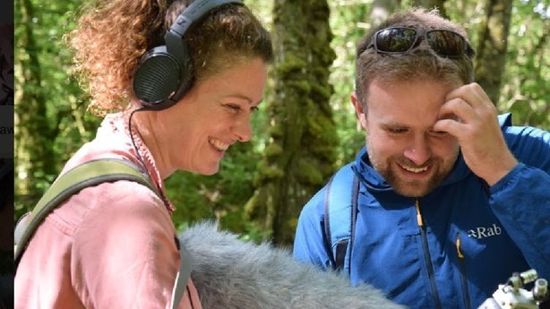
The environmental philosopher Raymond Rogers says that when we lose a species, we also lose our relationship with it, a phenomenon he describes as a “double disappearance”. My wife Michelle and I have spent much of the past year making this radio documentary on the Eurasian curlew’s special place in Irish songs, stories, poetry and art, asking what happens to human culture when we lose an iconic bird, and what we can do to bring them back from the brink of extinction. You can listen here, or search for ‘The Lyric Feature’ wherever you get your podcasts, and search for the episode of 5 March 2023.

The Lyric Feature: Wild

A deep-time audio journey across the Irish landscape

RTÉ Lyric FM, October 2020

I served as co-producer, with Anja Murray, of this one-hour radio documentary exploring the past and present of nature in Ireland — and peering into its imagined future. Broadcast by The Lyric Feature on RTÉ Lyric FM, you can listen here or search for The Lyric Feature wherever you get your podcasts. The programme was broadcast on October 11 2020.

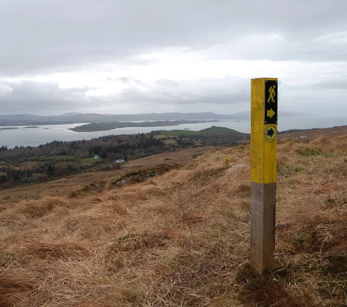
A Connemara island on the first day of spring

A Connemara island on the first day of spring

Luibin Garumna is a new trail that explores this less-visited Gaeltacht region 

Irish Times, March 7, 2018

In my mind the real Connemara is not to be found on the tour-bus routes that pass Killary Harbour or Kylemore Abbey, but in places like Ceantar na hOileán, the archipelago of Gaeltacht islands in the south-west of the region. 

Far from tourist hotspots, devoid of iconic mountains, and at the end of a road that leads nowhere, na hOileán is a densely populated and thriving Gaeltacht with a strange landscape all of its own. A new looped walk explores the largest of the islands here, Garumna. 

Read More

A wood in winter

A wood in winter

Rosscahill Woods in Galway are little-known, but together with nearby Brigit’s Garden, make for a fine day out

Irish Times, January 24, 2018

For anyone traveling west towards the mountains of Connemara, Ross Lake near Moycullen is an early sign of the wildness beyond. Coming from Galway City, the lake catches your eye with its thickly wooded shore, and the striking lime façade of the towering manor on its north bank.  

Most walkers drive on to the hills and coast further west. But the forest on the western shore of the lake makes for a fine short ramble, and on a cold day in early winter we walked here under mercurial skies. 

Read More

Follow the song of the paddle

Follow the song of the paddle

Lenny Antonelli spends a slow weekend exploring the Barrow valley on a canoe-camping trip

Irish Times, August 26, 2017

The canoe might be the finest vessel ever built for the traveller. In a canoe you can explore slowly and intently, just like walking or cycling, but from the water you see everything from a new perspective. The landscape takes on a certain freshness.

My first trip in a Canadian-style open canoe was on the Royal Canal in 2015, paddling slowly from Enfield to Mullingar over three days. Then I canoed the Barrow and Upper Lough Erne, each time camping along the way. In July of this year, I returned to the Barrow, the best of Ireland’s big rivers.

Read More

Land of shade and shadow

Land of shade and shadow

This corner of the Burren is full of ambiguity, writes Lenny Antonelli

Irish Times, June 7, 2017

The Irish uplands are often a study of definites, in open spaces and hard borders. Desolate mountains stretch into the distance. Dark blocks of spruces end abruptly at fences. Drystone walls enclose green fields perfectly.

But one particular corner of the Burren is full of ambiguity. The area around Mullaghmore, in the south-east Burren, is an amorphous place where grasslands, turloughs, scrub and woods shift and dissolve into one another.

I am drawn back here over and over. And on a grey, tepid day in early May I set out to undertake a grand traverse of this region, following the Burren Way with two friends.

Read More

Lush woods and open heath above Bantry Bay

Lush woods and open heath above Bantry Bay

This short, rugged trail follows in the footsteps of a pioneering Irish botanist

Irish Times, March 29, 2017 

In just a few short kilometres this fine little trail near Glengarriff explores lush woods and open heath high above Bantry Bay. The trailhead is beside a fine old bridge over the Coomhola River.

With your back to the mapboard, go left until you see the trail beside a house on your right, heading into the woods. You follow this hazel-lined path into a dark, damp forest rich in mosses and ferns.

Keep your eyes peeled for the blue arrows of the Coorycommane Loop as they guide you through the trees, eventually bringing you out to a muddy lane lined with brambles, gorse and pine. You are also following the yellow waymarkers of the Beara Way here.

Read More

Return of the native

Return of the native

White-tailed eagles went extinct in Ireland a century ago. Lenny Antonelli visits an ambitious project returning these huge raptors to Irish skies.

BBC Wildlife, December 2016

Our boat moves over clear green water, gliding towards the massive nest. Nearby a common seal dozes on a rock exposed by the low tide, while off to our stern another lifts its head above the water. It’s June and I’m on the Lady Ellen, a small boat piloted by ferryman Kevin Jer O’Sullivan.

We’re motoring over Glengarriff Harbour, a sheltered bay dotted with wooded islands and surrounded by old oak forests, in County Cork in the south-west of Ireland.

Kevin slows the boat as we approach the nest, high above in a Scots pine. But branches obscure the big white-tailed eagle chick, making him difficult to see. “Wait ’til I show you herself!” Kevin says in his thick Cork accent. He points to the vast adult female on a branch right ahead of us. I’m stunned into silence.

Later that morning, watching the nest from the shore, National Parks & Wildlife Service ranger Clare Heardman tells me this bird’s dramatic story. She and her mate were among 100 white-tailed eagles released into nearby Killarney National Park in 2007–11, as part of an ambitious plan to re-establish the species in Ireland.

In 2014 the Glengarriff pair hatched their first chick, but it died after two weeks. The next summer two chicks hatched – again, one died, but the other chick developed well and Clare looked forward to it becoming the first eagle hatched in Cork in more than a century.

Read More

Where's the wild in Wild Nephin?

Where's the wild in Wild Nephin?

Many Irish wildlife enthusiasts have been asking one question over the past year – what’s going on with the Wild Nephin rewilding project? Lenny Antonelli digs a little deeper.

Irish Wildlife magazine, Winter 2016/17

Jointly announced three years ago by the State forestry company Coillte and the National Parks and Wildlife Service (NPWS), the Wild Nephin Project’s stated aim is to create an 11,000 hectare wilderness area in the Nephin Beg mountains of north west Mayo. The most exciting element is perhaps Coillte’s plan to take 4,000 plus hectares of lodgepole pine and spruce forestry out of commercial operation, and to ‘re-wild’ the plantation into a large-scale mosaic of mixed woods and bogland. 

Coillte said this would be achieved by thinning out the dense conifer stands, introducing native trees, and blocking forest drains to restore bogland. Rather than take an intensive approach to management Wild Nephin, as the project is known, would take these initial steps – then stand back and let nature take over. Under the plans, the forests would be combined with the mountains and bogland of the adjoining Ballycroy National Park to create a large-scale ‘wilderness’ area – the first of its kind in Ireland. Forest roads would be closed to vehicles, and simple huts erected for backpackers, in a bid to facilitate ‘primitive’ recreation.

Read More

'In my mind it had become near-mythic': a bike tour of the Beara Peninsula

'In my mind it had become near-mythic': a bike tour of the Beara Peninsula

A week-long tour of the picturesque area leads to ancient woods, arty villages and colourful characters

Lenny Antonelli, Irish Times, August 13, 2016

The whistle-stop schedules of tourists visiting Ireland can sound exhausting. The Ring of Kerry and Giant’s Causeway in one week? “They should just spend a week exploring one peninsula,” a friend once said, after we’d been talking to some Americans who told us their travel itinerary.

I decided to borrow his idea. Despite walking and cycling much of the west coast over the past decade, I had never been to the south-west’s mountainous Beara peninsula, and in my mind it had become near-mythic.

The place-names sounded exotic to me: Allihies, Eyeries, Lauragh, Tuosist. The peninsula itself is said to be named for Princess Beara, the Spanish wife of Eoghan Mór, legendary King of Munster.

It seemed like a place that called for slow exploration. So on a warm, cloudy Monday, I loaded a mountain bike with my tent and sleeping bag and cycled south from Kenmare. I had one week ahead of me and no plan in particular, except to find out what – if anything – makes Beara unique.

Read More

Lessons from a wild Europe

Lessons from a wild Europe

Europe’s wildlife is on the march as wolves, lynx, bears, beavers and bison reclaim their former haunts. Now this rewilding success offers a compelling vision of how – if attitudes change – big mammals and people could flourish together in Britain. Lenny Antonelli reports.

BBC Wildlife, Spring 2015

Leo Linnartz is searching for phantoms in the forest. The Dutch ecologist is looking for wolves in the Netherlands, a country that doesn’t officially have any, but he’s expecting them any day now. The wolf population in neighbouring Germany is spreading, and it seems only a matter of time before they cross the border.

A lone female wolf has settled less than 30km away inside Germany. Juvenile wolves typically strike out from the pack to claim a territory of their own, often travelling hundreds of kilometres. So if this lone female has pups it’s inevitable that some will slink towards Holland.

Leo’s group Wolves in the Netherlands has set up camera-traps in forests and nature reserves along the border. So far they’ve only captured images of deer and wild boar. But even with 30 trailcams, the chances of photographing any wolves that cross over are slim. “It’s like searching for a needle in a haystack,” Leo says.

Indeed, wolves have probably already visited the Netherlands. In 2011 motorists captured pictures of a wolf-like animal in the Dutch town of Duiven, but the images weren’t 100 per cent conclusive. That same year a film crew searching for lynx in the Ardennes Mountains of southern Belgium put a camera beside the carcass of a sheep killed the night before. That night they captured footage of it being dragged off by a wolf, the first confirmed in Belgium for over a century.

New wolf packs have also sprung up in Germany, France and Switzerland. And late in 2012 a wolf was found dead in Denmark, the first recorded in the country for 199 years. An autopsy revealed that it died of natural causes. The following year researchers found evidence of 11 male wolves in the country. And if wolves can survive in Denmark’s heavily modified landscape, where can’t they?

Read More

Huge Romanian rewildling project aims to create 'European Yellowstone'

Earth Island Journal, 11 May 2015

In an ambitious new rewilding project, conservationists hope to create a ‘European Yellowstone’ amid the beech woods, spruce plantations and alpine pastures of Romania’s Fagaras Mountains. Backed by wealthy donors, the nonprofit Foundation Conservation Carpathia (FCC) is buying land for what it hopes will ultimately become a vast national park.

So far FCC has spent €45 million buying 40,000 acres of land, but the group’s ultimate goal is to protect 500,000 acres, which it then plans to donate back to the people of Romania. Although FCC is buying some of this land, the group also hopes to convince some stakeholders — such as the state and other local landowners— to put their land into the park. FCC’s largest backer is the Wyss Foundation, a philanthropic group founded by the Swiss medical devices billionaire Hansorg Wyss, which has already contributed $175 million to protect 14 million acres of wild land in the American West.

The Fagaras Mountains lie at the southern end of the 1,000-mile long Carpathian range, which stretches across east and central Europe. The Carpathians are a stronghold for Europe’s three big predators — the grey wolf, brown bear, and Eurasian lynx — as well as the continent’s most extensive old growth forests.

Read More

The wild streets of Galway

The wild streets of Galway

Take an urban safari on the city's waterways

Irish Times, February 22, 2015

I know few betters ways to see wildlife in Ireland than to walk Galway’s inner bay, and waterways. Start from the aquarium in Salthill and follow the prom towards the city. For me, Galway Bay seems most vital on calm autumn evenings, when the syrup-still water shakes with life as mackerel chase sprat inshore, while seals and gulls stalk the frenzy.

The prom brings you to Grattan Beach, where I’ve found everything from cuttlefish to sea stars to small conger eels in tidepools. Past here, you can walk the causeway out to Mutton Island, under an amphitheatre of mercurial light and weather. But don’t venture out here in high winds or very high tides. The causeway was the first place I saw an otter: when I approached at dusk, a lone walker, it slinked from the road into the sea and was gone.

Read More

Walking with the tides

Time your visit to this mysterious tidal island with care

Irish Times, 10 January 2015

For years, Omey Island seemed a near-mythical place to me. Despite exploring much of the Connemara coast I had never been to this tidal island, which you can walk to at low water but which becomes cut off at high tide. Inishbofin, Inishark and Inishturk print their silhouettes indelibly on the western skyline, but Omey hides away under the Aughrus Peninsula.

You can cross the wide strand from Claddaghduff Quay to Omey around low water from roughly half-tide to half-tide. But tidal conditions vary each day, and with the weather, so ask in Sweeney’s shop and pub in Claddaghduff for local advice before setting out.

We crossed Omey Strand an hour before low tide one gusty October day, roughly following a route described in Paul Phelan’s book Connemara and Mayo: A Walking Guide (Collins Press, 2012). Rather than follow the signposts all the way over the strand, this route veers right towards a prominent house near the island’s northeastern corner.

As we crossed the beach, a hearse started out across the hard sands, followed by cars. The burial procession advanced slowly through the grey wind, bound for Omey’s graveyard.

As you reach Omey, turn right and follow the shore, passing the graveyard if you haven’t already. Ignore the sandy road leading inland towards the house and continue along the beach. You can now pick up a sandy track above the curving shoreline and follow the northern coast (no fence-hopping required).

You will come to one beach, then another. Where a fence turns inland above the second beach, follow it to the remains of Teampall Féichín. This medieval church was built on the site of an earlier monastic settlement founded by St Féichín. Omey’s Gaelic name is Iomaidh Féichín, the bed of Féichín.

Return to the beach and continue to follow the shore. This exposed corner of the island is called Guairín, meaning small dunes, according to Tim Robinson’s book Connemara: The Last Pool of Darkness, from which I have gleaned much of my information. It is mostly machair, a sandy grassland only found in western Ireland and Scotland. The grass is populated by snails that use the lime-rich sands to build their shells.

You will reach the island’s northwest corner, where there is another small tidal island offshore, and, further west, Cruagh Island. Follow the shore of Omey as it turns and heads southeast.

The wind was heavy and the sky grey – not a solid grey, but a fluid mass of moving shades and shapes. To the south, towards Slyne Head, the dim sunlight broke through in crepuscular rays. Keep the sea on your right until you come to a small bay. St Féichín’s well, where pilgrims have left strange trinkets, is above the shore here.

In 1841, Omey was home to 396 people; just 10 years later, after the Famine, this had almost halved. The island’s school closed in 1973, and today there is just one year-round resident.

Cross the beach, join the road by two mobile homes and go left, past the lake and back down to Omey Strand. Presuming you haven’t horribly miscalculated the tides, you can follow the posts back across the sand to Claddaghduff.

WALK: OMEY ISLAND, CO GALWAY

Map: OSI, Discovery Series Sheet 37.

Start/finish: Claddaghduff Quay, Co Galway. The turn for Claddaghduff and Omey is about 3.5km north of Clifden on the N59. Turn at Claddaghduff church for the quay, or continue straight for Sweeney’s shop/pub.

Time and distance: Roughly 8km, 2.5 to 3 hours.

Suitability: Easy to moderate walking. Head out well before low tide. Omey has no services.

Secrets of Slieve Bloom

Walk in a wooded valley in the Slieve Bloom mountains

Irish Times, 30 August, 2014

An experienced hillwalker once told me that his least favourite range was the Slieve Bloom mountains of Laois and Offaly. I can’t recall his reasoning, but I imagine it might have been that it’s boggy and fairly flat, with no soaring peaks, and covered in forestry.

But the Slieve Blooms hide glorious secrets. Having lots of wooded rivers in one small range is invigorating, and you can explore one of these by walking the Brittas loop at Clonaslee, Co Laois.

The Slieve Blooms were behind a wall of mist when I approached, after heavy showers soaked the midlands. From the trailhead, the blue markers followed a track into woods along the river, where there was plenty of hazel, beech, ash, and Douglas fir.

These woods are part of the old Brittas estate, held by MP Francis Plunkett Dunne, who built nearby Brittas House in 1869. The Dunnes were said to be descendants of the legendary high king of Ireland, Cathair Mór.

The trail passes an old weir and the ruins of an old bridge. You will pass new footbridges too, but stay on the right bank as the trail goes through a series of stiles. After a while the track climbs away from the river, leaves the wood and joins a grassy lane between two fields.

Hints of autumn were everywhere: blackberries ripening, bracken beginning to rust and birch leaves yellowing. The boreen emerges to a road, where the trail turns right, then immediately left into more woods of beech and holly.

The path brings you to Brittas lake, built as a reservoir for the old estate, with water pumped up from the Clodiagh river. There are picnic benches and old fishing stands.

Beside the lake is a grove of Scots pine, a graceful tree rooted deeply in Ireland’s ecological past. This species once thrived on Ireland’s uplands and marginal habitats, but was pushed out as the climate grew wetter, bogs expanded and early farmers cleared the land. It may have survived in isolated refuges. But most Scots pine across the country today is from Scottish stock.

The waymarkers at Brittas lake are a little confusing, but essentially they direct you to lap the lake fully. As you leave the lake behind, rather than turn left down the path you came from through the woods, continue straight to some barriers, and go left.

There was once a large oak forest here, and you can see old oaks along the track. When you reach a fork, follow the waymarker right. A bit further on, you swing left where a grassy track leads off to the right.

Here a fallow deer and her fawn stood on the path ahead of me. I expected them to bolt, but the mother strayed into the woods, leaving the youngster behind to stare dumbly at me. I moved closer, until the mother returned and both deer darted. The route then crosses straight over a forest road and onto a grassy lane. Where a fallen tree blocks the path, circle around it to the left. The path emerges through an old gate of the Brittas estate to the west side of Clonaslee village.

From here you can continue straight on past some houses to reach the crossroads, where you turn right for the trailhead to complete the loop.

Map: OSI Discovery Series Sheet 54, or download from coillteoutdoors.ie. Start/finish: Clonaslee, Co Laois, 14.5km west of Mountmellick on the R422. From the crossroads by MD Hickey’s pub, take the road south along Clodiagh river, towards the mountains. Trailhead is on your left. Time and distance: 8km, 2 to 2.5 hours, not including breaks. Suitability: Graded moderate. Trail follows woodland trails, forest tracks and farmland lanes. Some parts are wet and muddy.

Those not-so-wild Europeans

Re-creating wilderness on a continent that has almost none

Sierra magazine, July/August 2014

In Ireland’s blustery Nephin Beg Mountains, the state-owned forestry company Coillte is rewilding roughly 11,000 acres of pine and spruce plantation. By thinning the canopy, closing logging roads, and establishing a system of shelters, it hopes to turn this industrial forest and parts of neighbouring Ballycroy National Park into a 27,000-acre recreational wilderness.

Coillte won’t fully liberate the forest to natural processes for another 14 years. But when it does, this will will be a rare parcel of European land unmanaged by humans. “We actually want our landscape to become one where there are no humans driving the changes,” says Bill Murphy, who’s overseeing the project for Coillte.

Nobody is certain how much wilderness Europe has left, but the best estimates say it’s 1 percent or less. Most of this land is in the east, where bison roam Poland’s Białowieza Forest, old-growth trees carpet the Carpathian Mountains, and taiga blankets the Russia-Finland border. The rest of Europe has been paved, cultivated, grazed, logged, urbanized, or otherwise degraded.

Definitions of “wildland” and the laws protecting it vary across the continent. Europe has no shared wilderness literature or history, says Mark Fisher, an honorary research fellow at the Wildland Research Institute; there is no European Muir or Leopold. While America’s early preservationists were idealists who fought to protect wild places from development and safeguard the public’s right to explore them, their European counterparts were instead driven by the science of conserving species and habitats.

The planned wilderness in the Nephin Beg Mountains, called Wild Nephin, is part of Western Europe’s nascent rewilding movement. In Germany, the Brandenburg Wilderness Foundation is returning vast military camps to the wild, while in Scotland, the nonprofit Trees for Life is restoring Caledonian Forest to highlands. All three projects are guided by the principle that nature can take over again, so long as it gets a leg up.

Up to now, hikers have shared Nephin’s forest tracks with logging trucks. But Coillte plans to cease commercial logging, shut out motorized vehicles, and turn forest roads into rough trails. When rewilding is complete, backpackers will be able to hike through Ireland’s most extensive wild forest, camp in backcountry shelters, and explore a roadless expanse of woods, mountain, and bog with no trace of human habitation or modern infrastructure.

It’s a paradoxic, of course, that such rewilding requires human intervention. But if Europe succeeds, hearts and minds may follow, and Nephin’s resurrected forests, bogland, and rivers could serve as a glimpse of Europe’s modern frontier.

Land of woods and water

Walk the woodlands and turloughs of little-known Garryland

Irish Times, 28 June, 2014

You’ve probably heard of Coole Park, the former home of Lady Gregory and setting of famous WB Yeats poems. But you might not have heard of Garryland, which is where Yeats’s hipster cousin might have hung out: it’s just around the corner but way less visited and that much harder to find.

The whole interconnected Coole-Garryland complex must be one of Ireland’s richest nature reserves, with 400 hectares of woodland, turlough, limestone pavement and grassland. But the Garryland side sees little footfall compared to Coole.

Leaving the Garryland car park, the woods along the trail are rich with hazel and ash. These trees are often found together on limestone, and they thrive here on the lowlands east of the Burren.

I recently heard a local farmer say that there’s no place on earth like the Burren in spring and, though you’re not really in the heart of the Burren here, you can sense its presence in the trees, wildflowers and rock.

The old building beside the trail, just after you enter the wood, is used as a summer roost by more than 60 lesser horseshoe bats. Close by there’s also a specially built hibernaculum, an underground chamber for the bats to hibernate in during winter.

We took a side-trail and followed it to a dead end, then continued on a rougher track into the woods. We startled two hares from the path and they hopped off, bouncing noisily through the undergrowth. All along, the trails were spotted with the scat of pine marten.

The air was so warm and sticky that Garryland felt more like primordial jungle than an Irish woodland: bugs attacked my neck, the air was thick and humid, and the wind dropped to nothing.

Later we took a side path down to the dry grassy bed of a turlough. These “disappearing lakes”, fed by groundwater during wet weather, are interwoven with the forests here, stretching their watery fingers deep into the woods. There’s nowhere else in Ireland where turloughs are so intimately associated with old woodland.

We passed a grove of oaks and one old yew, then rested on a rock in a clearing. “It looks like something out of Jurassic Park,” my walking buddy said, staring at the scene in front of us: a small turlough, surrounded by a grassy savannah that was dotted with boulders. I could see what she meant: it looked so green and primeval that we half expected Brontosaurus to emerge from behind the hawthorns.

But when the turloughs rise in wet weather, the trails flood. You probably won’t get far if you come here in mid winter, so visit in summer during a dry spell.

The full linear walk from the Garryland car park to Coole is almost 5km one-way, and you could make this much longer by exploring different side paths. This is what makes Coole-Garryland so special: there are few other places in Ireland where you can spend so long walking through woodland (unless you like walking in circles).

But the swampiness of the day seemed to call for a lazier approach. After resting we turned back, then took a different trail to another turlough fringed by steep limestone crags. Tired and thirsty, we walked back to the car park in the still May heat.

Go Walk: Garryland Woods

Map: OSI Discovery Series Sheet 52 covers the area but may not show trail details.

Start and finish: Garryland Woods car park. From Gort take the R460 towards Corofin, but turn right for Kinvara almost 1km after crossing over the motorway. Follow this minor road for 2.5km and take the first right. The car park is 1.5km up on your right hand side. Room for only a few cars.

Time and distance: My walk was 7km / 2 hours with breaks, but this can easily be made longer or shorter such is the variety of trails.

Suitability: The main paths are flat and easy, but side trails can be rougher. Go during dry weather in summer as the trails flood in wet weather / winter.

Info: Coole Park Visitor Centre (www.coolepark.ie).

Services: There are seasonal tea rooms at Coole Park and full services in Gort.

Fishy chat-up lines and underwater love among Arctic char

Scientists in Galway are attempting to eavesdrop on the sounds Arctic char make during courtship in the hope of protecting this threatened fish

Irish Times, 1 May 2014

What does the fish say? New research at Galway-Mayo Institute of Technology (GMIT) aims to shed light on just how vocal a unique Irish fish is. Biologists hope to discover whether Arctic char, a deepwater inhabitant of Irish lakes, vocalise. during courtship and spawning.

Researchers hope that, by recording char in the lab, they can use its unique call to pinpoint where it spawns in lakes in the hope of offering it better protection.

About 700 species of bony fish are known to vocalise. Most do this by contracting their swim bladder to produce pulsating drum-like calls. In many species, sound is produced by males as they compete with each other and try to attract mates.

Sound travels farther underwater than light, says PhD researcher Marta Bolgan, and it doesn’t dissipate as quickly as chemical signals, making it a logical communication medium for fish. But fish acoustics are poorly understood compared with those of aquatic mammals such as whales and dolphins, and freshwater fish are the least-studied of all.

At a fish farm in Galway, Bolgan has recorded what seem to be sounds produced by Arctic char. She believes these may be the first Arctic char vocalisations recorded by scientists. Bolgan now hopes to record the species spawning in the lab to confirm whether it vocalises, and to figure out why.

To coax the fish into breeding, she tries to recreate its natural spawning conditions in freshwater tanks: cold water temperatures (6-8 degrees) and a short daylight period recreated using lamps.

Bolgan keeps male and female char separately, but once the females are ripe with eggs, she transfers two males and one female to an observation tank. For the first two days she keeps the sexes separate using a divider.

Each time, the males appear to compete until one has established dominance. “One male keeps swimming around the tank and the other hides,” she says. Often the female will dig a nest in the gravel bedding to prepare for spawning.

When she removes the divider, the courtship ritual begins. “The [dominant] male swims with the mouth really close to the tail of the female, and the mouth of the female is really close to the tail of the male. They swim in a circular pattern, and they can go on like this for a couple of hours.”

But there’s one catch: of the nine pairs she has observed at the time of writing, none have completed spawning, and Bolgan has yet to hear any vocalise. She says that because her char are from farmed populations, they may have lost the ability to breed naturally, or her observation tank may be too small for spawning.

“I have a feeling that they rely more on other communication channels. We can’t exclude sound production yet, but maybe it’s not their main communication channel,” she says. Nonetheless, her research still provides new insight into the behaviour of Arctic char.

Later this year, Bolgan will record underwater at Lake Windermere in Cumbria, where the exact location of char spawning grounds is known. She’s hoping to film the fish here too. This should provide better evidence as to whether wild char vocalise during the breeding season.

But even if Arctic char aren’t vocal, they’re still likely to use sound. Bolgan says all fish hear and use sound to pick up information about their environment – for detecting prey, avoiding predators and locating spawning and feeding grounds. Research has shown that many species of reef fish use acoustic information to locate their spawning grounds. “The soundscape is like a fingerprint. Every area sounds different,” she says.

Scientists don’t know how salmon locate their spawning grounds, but sound could provide one explanation. A research student at GMIT now hopes to record salmon vocalising at the Marine Institute facility in Mayo later this year. Understanding fish acoustics is vital for their conservation, says Bolgan’s supervisor, biologist Dr Joanne O’Brien. The idea is to minimise human noise at critical points in their life cycle. One of O’Brien’s long-term goals is to set up underwater recording stations in Irish lakes to monitor fish populations remotely.

While marine mammals tend to communicate in a wide range of frequencies, fish use the same low frequencies occupied by noise from human activities such as shipping, putting them at greater risk.

“Noise affects fish and mammals in the same way,” says Bolgan. If I’m trying to speak with you and the noise gets louder, I don’t hear you.”

“So if my point in the communication is to aggregate with you to reproduce, maybe I don’t hear you, maybe I don’t manage to catch you, and reproduction fails.”

SPLENDID ISOLATION: A BRIEF HISTORY OF CHAR

Arctic char arrived in Ireland after the last ice age ended, more than 10,000 years ago. The species, a member of the salmon family, lives in the cold climates of the northern hemisphere and survives farther north than any other freshwater fish.

Like salmon, most Arctic char populations feed in the sea and migrate up rivers to spawn. But the Irish population is unique, spending its entire life cycle in freshwater – mostly in deep, cold lakes near the west coast.

One theory suggests that, after the ice sheets retreated, Irish char populations simply stopped migrating to warming seas, where competition and the risk of being eaten was higher. It has remained isolated in Irish lakes for millenniums.

Arctic char has been recorded in more than 70 Irish lakes, but is believed to be extinct in about a third of these now. It is rated as “vulnerable” on Ireland’s red list of threatened species, and its decline has been linked to the introduction of non-native fish. It requires cold, well-oxygenated water, so is also threatened by pollution and climate change.

The species spends most of the year in deep water, but comes up to shallow lake beds to breed in late autumn and winter. The female digs a nest and releases her eggs, which the male fertilises externally. But little is known about the specific spawning behaviour of char in Ireland or the exact location of breeding sites.

Marta Bolgan’s PhD at GMIT is funded by the Irish Research Council, while her research at Lake Windermere will be supported by the Marine Institute

Through the heartlands

Walking the Grand Canal Way across the bogs of Offaly

Irish Times, 26 April 2014

I left Tullamore on a proper Irish spring morning: icy wind on my face, warm sun on my back. My plan was to follow the Grand Canal Way west through the boggy heart of the midlands.

Just outside Tullamore the canal passes Shra Castle, built in 1588 by an English solider who married into a local family. But Ballycowan Castle, a bit further on, is even more striking.

Nearby the towpath crosses two aqueducts, engineering marvels that lift one waterway above another. Further on I spotted a peacock butterfly, my first of the year, its rusted wings spotted black, cream and lilac. The countryside here was flat and farmed. Some fields were wonderfully disordered, with overgrown hedgerows and rough grass. Others were smooth and symmetrical, their hedges hacked bare.

Seeing this, I thought of an eccentric landowner in the midlands who once who told me that when walking his land, I would know where his farm ended because the fields would suddenly become boring. He celebrated disorder, and I imagined him cursing the neatest fields beside the canal.

Later I was resting by a bog oak sculpture at Pollagh when a barge named the Cheerful Lady passed. She had left Tullamore when I did, but had fallen behind me waiting at a lock. “Maybe if you get tired they’ll give you a lift,” the man from Waterways Ireland had said. The barge and I exchanged pole position a few times until she pulled ahead at Pollagh, and that was the last time I saw her.

Past Pollagh the towpath vegetation was stripped bare, and I had to trudge through peaty mud. The Grand Canal Way stretches from west Dublin to the Shannon, and is marked along its whole length. The walking is flat, but in places the towpath is rough and muddy, so wear good walking shoes. Though this section follows quiet roads in parts, I encountered few cars. Make sure you stick with the waymarkers – if you walk on the opposite bank, you could find yourself hitting a dead end.

Then the land grew wilder, and the blooming gorse gave away its secret: I had entered bog country, where the canal passes through Bord na Móna’s great cutaway peatlands. The houses disappeared, and the land between towpath and bog filled with a hodgepodge of scrub, wood and field, more interesting that any single habitat. Nearby are the Turraun Wetlands, created when Bord na Móna flooded its exhausted peat fields. They form one section of Lough Boora Parklands, 2,000 hectares of cutaway bog where nature has retaken hold to create lakes, meadows, scrub and woodland. The parklands have walking trails, hides for birdwatching, bike hire and angling lakes.

Along the canal the towpath crosses one of Bord na Móna’s bog railways. Nearby something big seemed to tumble into the canal from the reeds. I scanned the water for an otter’s head, but none appeared. Later I watched a heron stalk fish from the towpath.

Early in the evening, I left the canal at Gallen and walked 2km by road into Ferbane. I had just enough time for a tipple before catching a bus out of the bog country.

Map: Trail maps at irishtrails.ie. OSI Discovery Series maps 48 & 47. Start: Bridge over the canal at the end of Colmcille Street ( a continuation of High Street & Bridge Street), Tullamore. Start on north side of the canal. Finish: Armstrong/Gallen Bridge, 2km south of Ferbane. Time & distance: 26.2km on the canal, plus 2km into Ferbane, took me 7.5 hours at brisk pace. But leave 10 hours of daylight for safety. Those preferring a shorter walk could tackle a stage: Tullamore to Pollagh (15.6km) or Pollagh to Armstrong/Gallen Bridge (10.6km).