Take a walk on the Grand side
/LENNY ANTONELLI walks a quiet section of the Grand Canal in Kildare
The Grand Canal Way is a rarity in Ireland: a long-distance walk that’s almost entirely off-road, stretching from Adamstown in west Dublin to Shannon Harbour, Co Offaly.
The section between Hazelhatch and Sallins is a perfect microcosm of it – a half day’s walk between two towns serviced by a railway whose own history is entangled in that of the canal.
I set out from Hazelhatch, where houseboats line the channel. This must be Dublin’s most chaotic and inspiriting row of homes: the barges are cream, red and highlighter blue, fat and slim, tall and squat. The towpath is decorated with bicycles, tables, old kayaks, wheelie bins, solar panels and wooden sculptures. Smoke rises from their chimneys, but nobody emerges from below deck, so I walk on.
Work began on the Grand Canal in 1756 in Clondalkin. But progress was slow, and it took more than two decades before the 20km channel to Sallins was open. Further west, the immense Bog of Allen almost sunk the project when clay walls built to support it failed. The Grand Canal finally reached the Shannon in 1803, but the age of fast rail travel was looming.
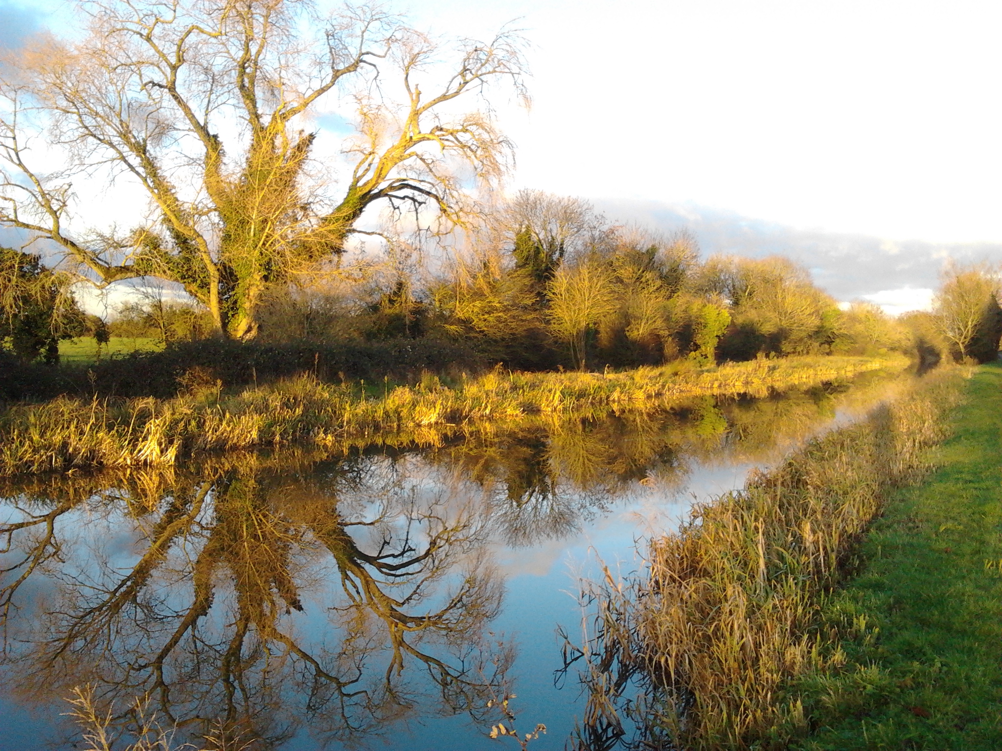
For those who normally walk the mountains or coast, the canal is an entirely different creature. While hillwalking is adventurous, canal-walking is ponderous – you needn’t worry about navigation or the terrain here, the towpath just carries you endlessly forwards. But our canals play a crucial ecological role, linking up rivers and lakes that would otherwise be isolated. And their landscape makes you pay attention for its subtler rewards, like a moorhen hiding in the sedges, or bubbles breaking on the water’s surface, perhaps released by a tench eating grubs on the floor of the canal.
Like a forgotten thoroughfare it sneaks behind fields and country estates. It’s hidden from Kildare’s modern commuter towns, and has an architecture all of its own. I passed steep stone bridges, derelict lock-keeper’s cottages, and an old canal-side church and school at Ardclough. I walked by the old Lyons demesne, with its immense Georgian manor, and Oughterard, where Arthur Guinness is buried and Daniel O’Connell killed John D’Esterre in a pistol duel in 1815. Bring a map though: often these features are behind high walls or rows of ivy-wrapped trees.
About half way to Sallins, the light started to disintegrate. Colour drained from the landscape, leaving only the black trees and the shadows they cast on the inky water. Walking in the half-light was thrilling, though, and dead silent except when my presence sent terrified birds screaming from the trees.
Soon I passed under the railway bridge just before Sallins. The Grand Canal Company fought the building of the railways, and this bridge proved pivotal: once the Great Southern and Western Railway Company won the right to bridge the canal in the 1840s, the rail network could stretch out to Cork, Limerick and Galway. Just two decades later, the mass transport of people and goods on the canal was finished.
WALK THE GRAND CANAL WAY
Map : OSI, Discovery Series, Sheets 49 and 50. Downloadable maps of the Grand Canal Way at (see also for train times).
Start : Hazlehatch Bridge, 600m from Hazelhatch and Celbridge rail station.
Finish : Trail ends at Sallins.
Time and distance : 12.6km. Takes four hours if you want to explore slowly.
Suitability : Easy. Bring food, water and warm, waterproof clothes and footwear.
Rail services: On the Dublin-Kildare line, with trains leaving Heuston station frequently.